
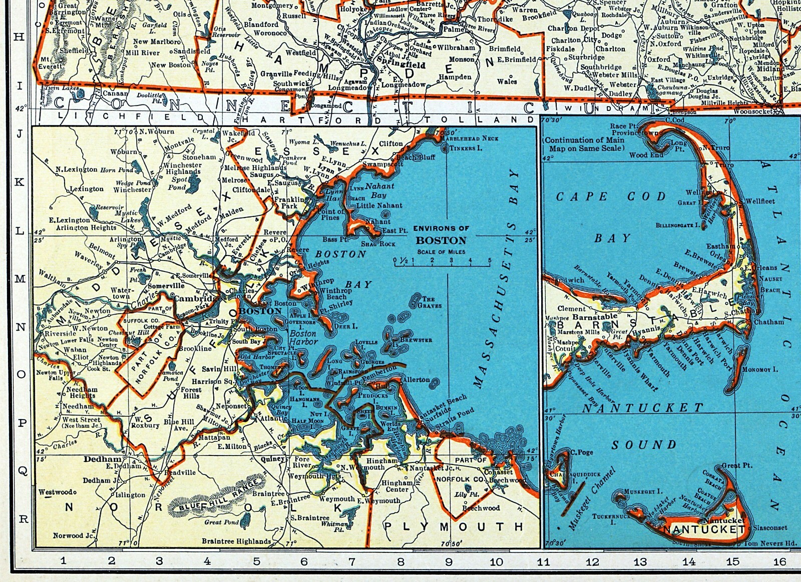
1937 Rand McNally Map Massachusetts Boston Plymouth Salem Cape Cod Barnstable MA
US $14.40US $14.40
Sep 18, 01:36Sep 18, 01:36
Picture 1 of 4


Gallery
Picture 1 of 4


Have one to sell?
1937 Rand McNally Map Massachusetts Boston Plymouth Salem Cape Cod Barnstable MA

US $14.40
ApproximatelyS$ 18.40
or Best Offer
Was US $18.00 (20% off)
Condition:
“Very Good to Excellent, a very nice map with a classic color scheme that would frame up well, see ”... Read moreabout condition
Ended: Sep 18, 2025 01:36:59 SGT
Oops! Looks like we're having trouble connecting to our server.
Refresh your browser window to try again.
Shipping:
US $4.99 (approx S$ 6.38) USPS Ground Advantage®.
Located in: Fairview, Pennsylvania, United States
Delivery:
Estimated between Tue, 23 Sep and Mon, 29 Sep to 94104
Returns:
30 days return. Seller pays for return shipping.
Coverage:
Read item description or contact seller for details. See all detailsSee all details on coverage
(Not eligible for eBay purchase protection programmes)
Seller assumes all responsibility for this listing.
eBay item number:405305911061
Item specifics
- Seller Notes
- Date Range
- 1930-1939
- Type
- Political Map
- Format
- Atlas Map
- US State
- CT, MA, ME, NH, RI, VT, Massachusetts
- Year
- 1937
- Original/Reproduction
- Antique Original
- Cartographer/Publisher
- Rand McNally & Co.
- City
- Boston
- Country/Region
- United States of America
Item description from the seller

Seller feedback (19,938)
- h***2 (1054)- Feedback left by buyer.Past monthVerified purchaseAs Advertised , Fast Shipping , A++++ Seller
- eBay automated feedback- Feedback left by buyer.Past monthOrder completed successfully—tracked and on time
- eBay automated feedback- Feedback left by buyer.Past monthOrder completed successfully—tracked and on time