Picture 1 of 12


Gallery
Picture 1 of 12


Have one to sell?
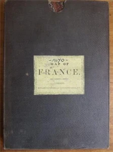
1870 Very Large Map of France, Carte De L'Empire Français, E. Andriveau-Gouj

GBP 220.00
ApproximatelyS$ 380.89
or Best Offer
Condition:
“Publisher: E. Andriveau-Goujon, Paris, sold by Edward Stanford, London. March 1870. this is a very ”... Read moreabout condition
Oops! Looks like we're having trouble connecting to our server.
Refresh your browser window to try again.
Shipping:
GBP 28.00 (approx S$ 48.48) International Tracked Postage.
Located in: Shrewsbury, United Kingdom
Delivery:
Estimated between Wed, 10 Sep and Thu, 25 Sep to 94104
Returns:
No returns accepted.
Coverage:
Read item description or contact seller for details. See all detailsSee all details on coverage
(Not eligible for eBay purchase protection programmes)
Seller assumes all responsibility for this listing.
eBay item number:403695297084
Item specifics
- Seller Notes
- Antique
- Yes
- Cartographer/Publisher
- E. Andriveau-Goujon
- City
- Paris
- Country/Region
- France
- Date Range
- 1800-1899
- Era
- 1800s
- Format
- Folding Map
- Original/Reproduction
- Antique Original
- Printing Technique
- Copper Plate
- Year
- 1870
Item description from the seller

Seller feedback (2,150)
- s***7 (114)- Feedback left by buyer.Past monthVerified purchaseReally great book and negotiated a fair price. Thanks very much for delivering quickly and packaging the item solidly. Exactly as described and very satisfied.
- Évaluations automatiques eBay- Feedback left by buyer.Past monthCommande terminée - avec suivi et dans les délais
- -***i (157)- Feedback left by buyer.Past monthVerified purchaseA pleasure to do business with.