
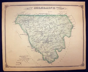
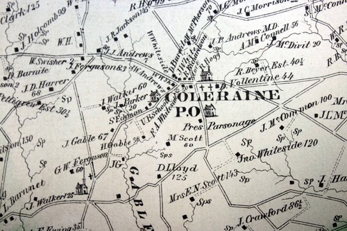
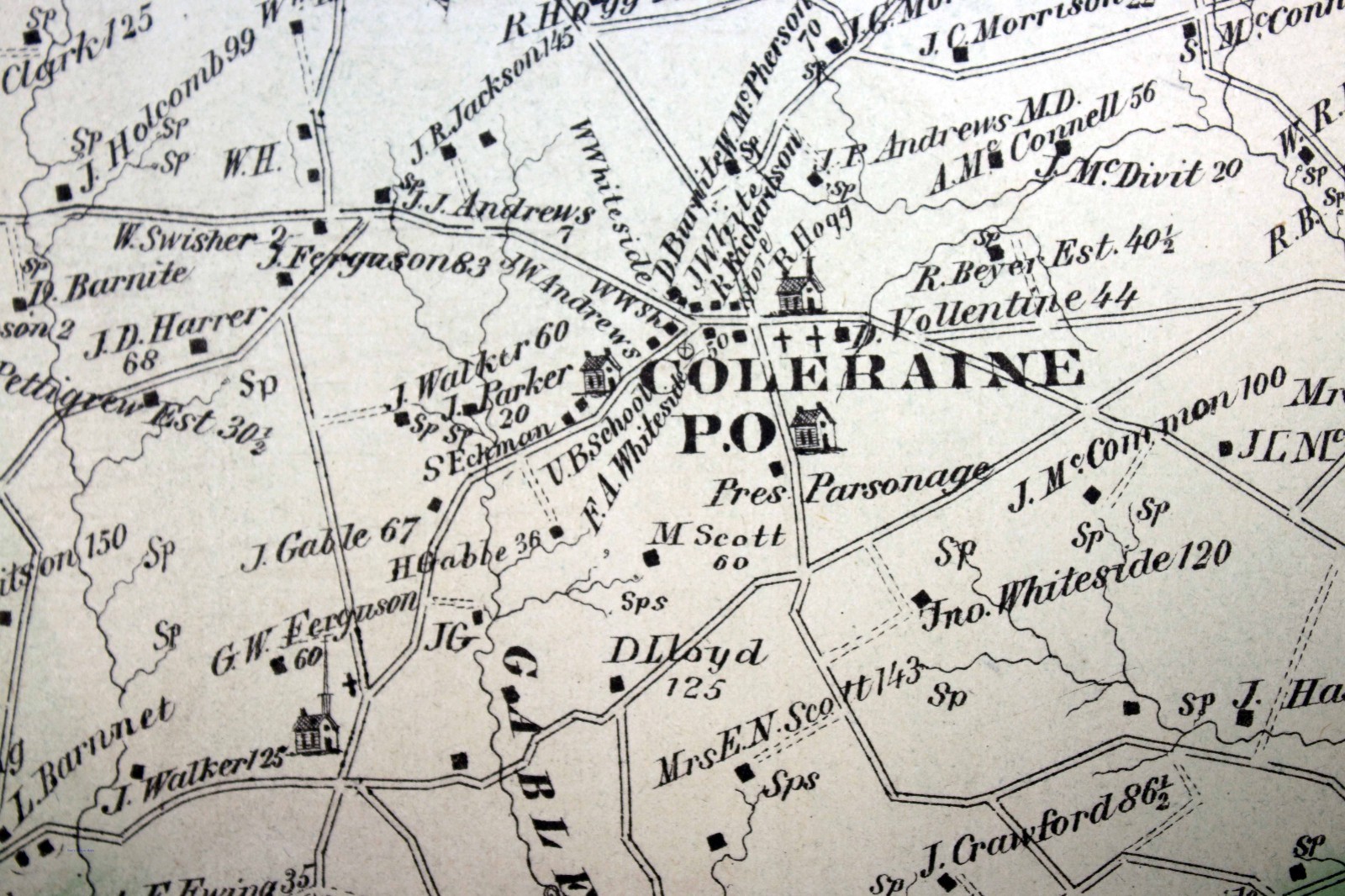
1875 Plat Map Coleraine Township Salisbury Township Lancaster County PA
US $32.50US $32.50
Aug 25, 09:25Aug 25, 09:25
Picture 1 of 13


Gallery
Picture 1 of 13


Have one to sell?
1875 Plat Map Coleraine Township Salisbury Township Lancaster County PA

Condition:
“Good condition (see photos).”
Ended: Aug 25, 2025 09:25:08 SGT
Oops! Looks like we're having trouble connecting to our server.
Refresh your browser window to try again.
Shipping:
US $8.75 (approx S$ 11.22) USPS Ground Advantage®.
Located in: Corunna, Michigan, United States
Delivery:
Estimated between Tue, 16 Sep and Mon, 22 Sep to 94104
Returns:
30 days return. Seller pays for return shipping.
Coverage:
Read item description or contact seller for details. See all detailsSee all details on coverage
(Not eligible for eBay purchase protection programmes)
Seller assumes all responsibility for this listing.
eBay item number:365805215834
Item specifics
- Seller Notes
- “Good condition (see photos).”
- Date Range
- 1800-1899
- Type
- Plat Map
- Format
- Atlas Map
- Printing Technique
- Engraving
- US State
- Pennsylvania
- Year
- 1875
- Original/Reproduction
- Antique Original
- Cartographer/Publisher
- Everts & Stewart
- City
- Lancaster
- Country/Region
- United States of America
Item description from the seller

Seller feedback (10,283)
- Évaluations automatiques eBay- Feedback left by buyer.Past monthCommande terminée - avec suivi et dans les délais
- Évaluations automatiques eBay- Feedback left by buyer.Past monthCommande terminée - avec suivi et dans les délais
- Évaluations automatiques eBay- Feedback left by buyer.Past monthCommande terminée - avec suivi et dans les délais