Picture 1 of 3


Gallery
Picture 1 of 3


Have one to sell?
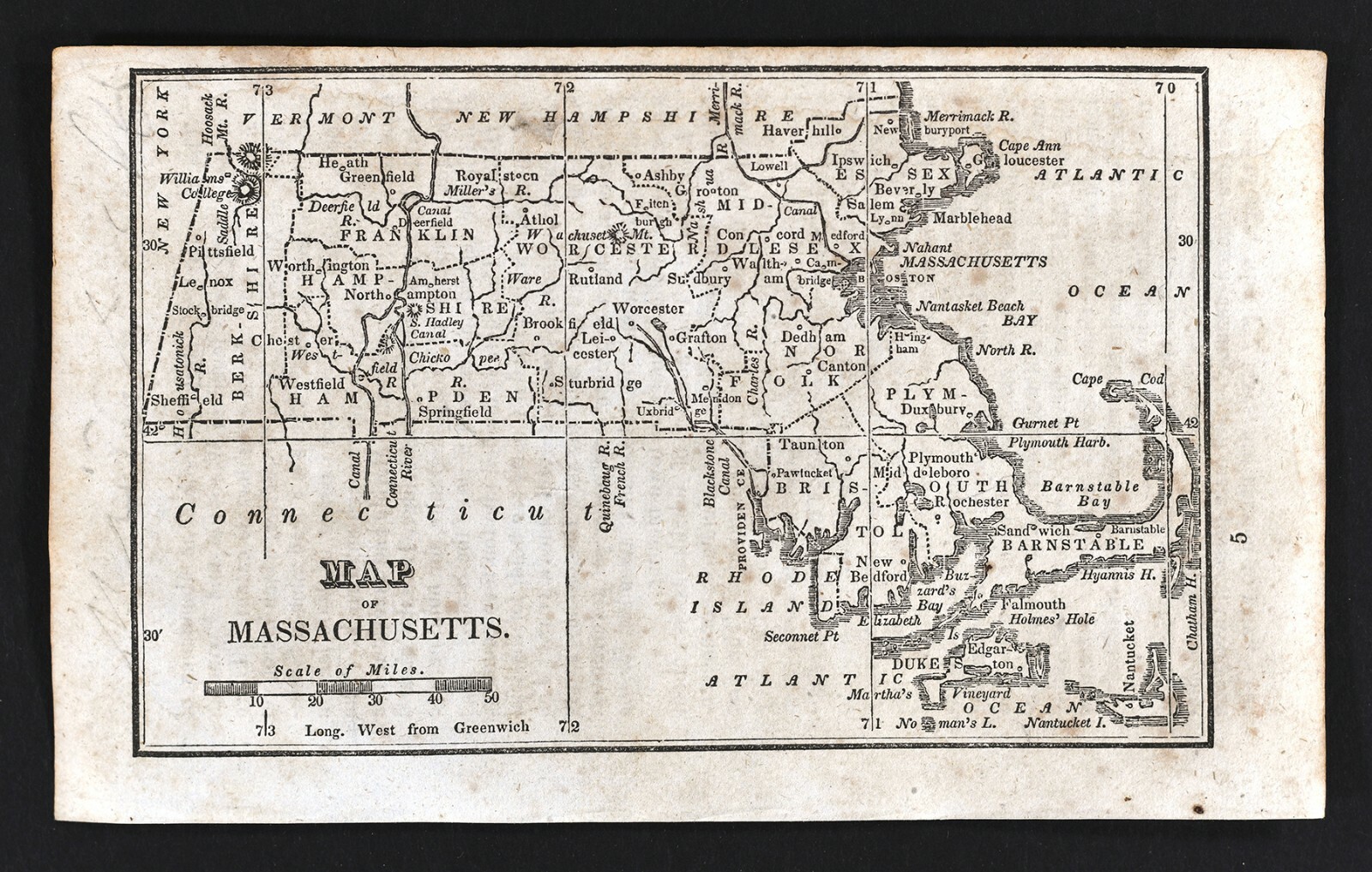
1830 Nathan Hale Map - Massachusetts - Boston Plymouth Cape Cod Salem Worcester

US $31.99
ApproximatelyS$ 40.99
Was US $39.99 (20% off)
Condition:
“Fair, it measures approximately 3 3/4 by 6 inches on a 4 1/2 by 7 1/4" page (11x18cm), there is ”... Read moreabout condition
Sale ends in: 2d 3h
Oops! Looks like we're having trouble connecting to our server.
Refresh your browser window to try again.
Shipping:
US $4.99 (approx S$ 6.39) USPS Ground Advantage®.
Located in: Fairview, Pennsylvania, United States
Delivery:
Estimated between Fri, 29 Aug and Sat, 6 Sep to 94104
Returns:
30 days return. Seller pays for return shipping.
Coverage:
Read item description or contact seller for details. See all detailsSee all details on coverage
(Not eligible for eBay purchase protection programmes)
Seller assumes all responsibility for this listing.
eBay item number:365352679962
Item specifics
- Seller Notes
- Cartographer/Publisher
- Nathan Hale
- Printing Technique
- Copper Plate
- Original/Reproduction
- Antique Original
- Format
- Atlas Map
- Type
- Political Map
- Year
- 1830
- US State
- CT, MA, ME, NH, RI, VT, Massachusetts
- Date Range
- 1800-1899
- City
- Boston
- Country/Region
- United States of America
Item description from the seller

Seller feedback (19,904)
- q***d (113)- Feedback left by buyer.Past monthVerified purchaseVery happy with my purchase overall - description, condition, delivery, everything was as expected/desired.
- q***d (113)- Feedback left by buyer.Past monthVerified purchaseVery happy with my purchase overall - description, condition, delivery, everything was as expected/desired.
- -***w (992)- Feedback left by buyer.Past monthVerified purchaseDescribed was Better than I expected. well Packaged