
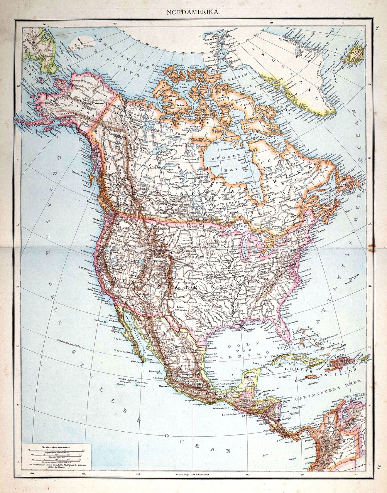
1881 Andrees Map North America United States Canada Mexico West Indies Alaska
US $23.99US $23.99
Jun 22, 10:28Jun 22, 10:28
Picture 1 of 5


Gallery
Picture 1 of 5


Have one to sell?
1881 Andrees Map North America United States Canada Mexico West Indies Alaska
US $23.99
ApproximatelyS$ 30.78
or Best Offer
Was US $29.99 (20% off)
Condition:
“Good, on a 16 1/2 by 22 inch (42x56cm) page, see the pic and description below for more on ”... Read moreabout condition
Ended: Jun 22, 2025 10:28:04 SGT
Oops! Looks like we're having trouble connecting to our server.
Refresh your browser window to try again.
Shipping:
US $4.99 (approx S$ 6.40) USPS Ground Advantage®.
Located in: Fairview, Pennsylvania, United States
Delivery:
Estimated between Thu, 21 Aug and Tue, 26 Aug to 94104
Returns:
30 days return. Seller pays for return shipping.
Coverage:
Read item description or contact seller for details. See all detailsSee all details on coverage
(Not eligible for eBay purchase protection programmes)
Seller assumes all responsibility for this listing.
eBay item number:365147570804
Item specifics
- Seller Notes
- Cartographer/Publisher
- Andrees
- Original/Reproduction
- Antique Original
- Canadian Province
- Alberta, British Columbia, Manitoba, New Brunswick, Nova Scotia, Ontario, Prince Edward Island
- Format
- Atlas Map
- Topic
- United States
- Region
- North America & Canada
- Type
- Political Map
- Year
- 1881
- US State
- AK, HI, AL, FL, GA, MS, NC, SC, Alaska, AR, IA, KS, LA, MO, NE, Arkansas, AZ, CA, CO, NM, NV, UT, Colorado, Texas
- Date Range
- 1800-1899
- City
- Washington
- Country/Region
- Canada
Item description from the seller
Seller Feedback
No feedback yet