Picture 1 of 5


Gallery
Picture 1 of 5


Have one to sell?
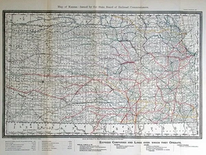
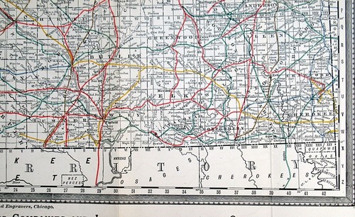
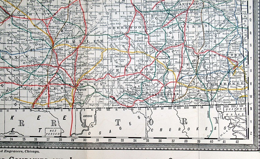
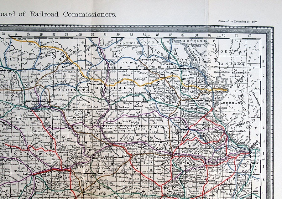
1888 KANSAS, SCARCE ANTIQUE RAILROAD COMMISSION MAP, RAND MCNALLY

US $75.00
ApproximatelyS$ 96.88
or Best Offer
Condition:
“Original map about 135 years old, not a reproduction. Excellent condition as seen in the ”... Read moreabout condition
Oops! Looks like we're having trouble connecting to our server.
Refresh your browser window to try again.
Shipping:
US $9.95 (approx S$ 12.85) USPS Priority Mail®.
Located in: Akron, Ohio, United States
Delivery:
Estimated between Wed, 1 Oct and Tue, 7 Oct to 94104
Returns:
30 days return. Buyer pays for return shipping. If you use an eBay shipping label, it will be deducted from your refund amount.
Coverage:
Read item description or contact seller for details. See all detailsSee all details on coverage
(Not eligible for eBay purchase protection programmes)
Seller assumes all responsibility for this listing.
eBay item number:357289473501
Item specifics
- Seller Notes
- Date Range
- 1800-1899
- Type
- Railroad Map
- Printing Technique
- Color-printed map
- Format
- Folding Map
- US State
- Kansas
- Year
- 1888
- Cartographer/Publisher
- Rand, McNally
- Original/Reproduction
- Antique Original
- Features
- Antique Original
- Country/Region
- United States of America
- Maker
- Rand, McNally
Item description from the seller

Seller feedback (4,115)
- Automatische Bewertung von eBay- Feedback left by buyer.Past monthBestellung erfolgreich durchgeführt - mit Sendungsverfolgung und fristgerecht
- Automatische Bewertung von eBay- Feedback left by buyer.Past monthBestellung erfolgreich durchgeführt - mit Sendungsverfolgung und fristgerecht
- Automatische Bewertung von eBay- Feedback left by buyer.Past monthBestellung erfolgreich durchgeführt - mit Sendungsverfolgung und fristgerecht