
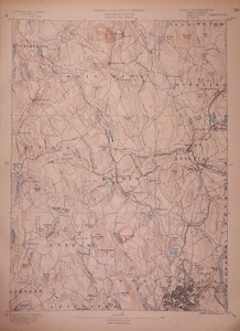
1890 Topographical Map, WORCESTER SHEET - HOLDEN, PEXTON, MA (15x20)#020
US $38.88US $38.88
Jul 04, 00:23Jul 04, 00:23
Picture 1 of 2

Gallery
Picture 1 of 2


Have one to sell?
1890 Topographical Map, WORCESTER SHEET - HOLDEN, PEXTON, MA (15x20)#020
US $38.88
ApproximatelyS$ 49.82
or Best Offer
Condition:
“This map is not *new* or *new* condition. It was removed from a Topographical Atlas of ”... Read moreabout condition
Oops! Looks like we're having trouble connecting to our server.
Refresh your browser window to try again.
Shipping:
Free USPS Ground Advantage®.
Located in: Schertz, Texas, United States
Delivery:
Estimated between Sat, 30 Aug and Sat, 6 Sep to 94104
Returns:
30 days return. Buyer pays for return shipping. If you use an eBay shipping label, it will be deducted from your refund amount.
Coverage:
Read item description or contact seller for details. See all detailsSee all details on coverage
(Not eligible for eBay purchase protection programmes)
Seller assumes all responsibility for this listing.
eBay item number:356338583908
Item specifics
- Seller Notes
- Type
- Topographical Map
- Format
- Sheet Map
- US State
- Massachusetts
- Year
- 1890
- S&H
- Free S&H USA - Calculated S&H Worldwide
- Cartographer/Publisher
- J.W. Powell / United States Geological Survey
- Original/Reproduction
- Antique Original
- Original
- This map page was printed in 1890.
- Age
- Over 130 years old.
Item description from the seller
Seller Feedback
No feedback yet