Picture 1 of 10


Gallery
Picture 1 of 10


Have one to sell?
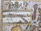
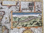
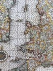
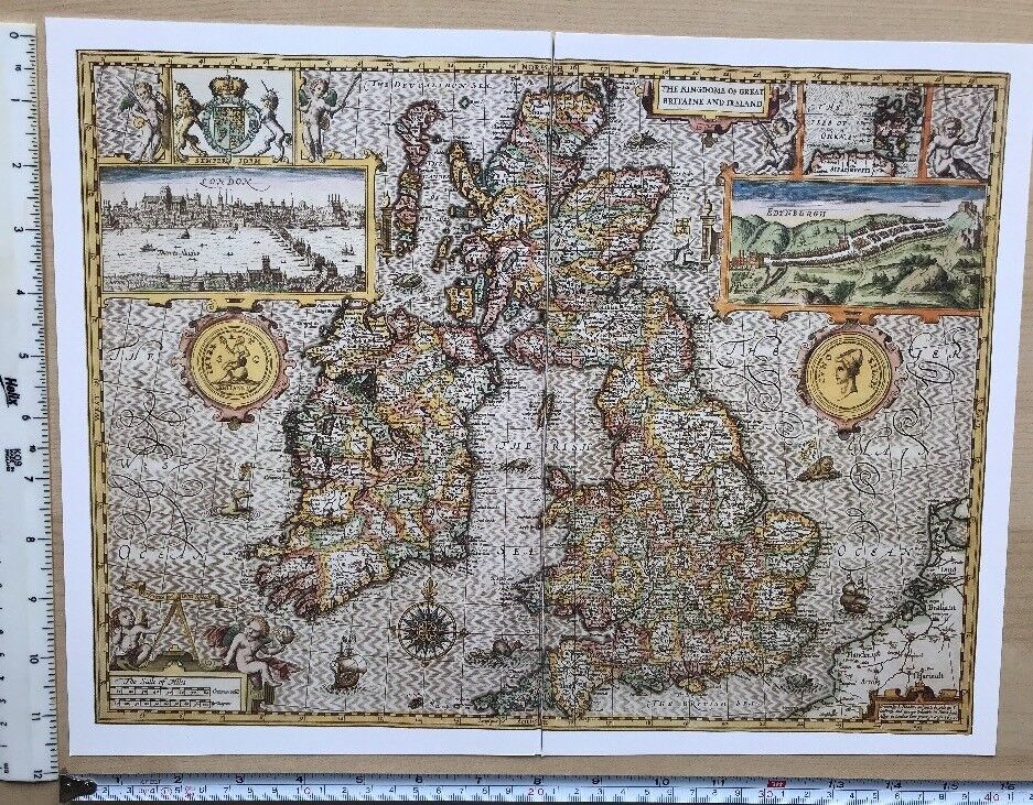
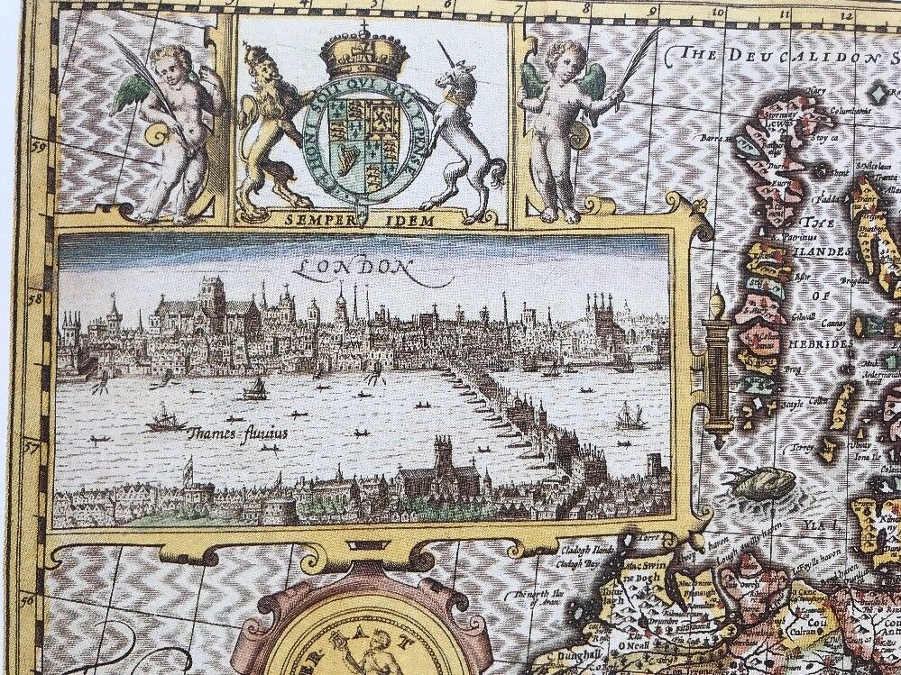
Antique Tudor map British Isles Britain Ireland London Edinburgh 1600s Reprint
GBP 4.99
ApproximatelyS$ 8.55
Condition:
“This map is a book plate taken very carefully from a book of maps printed in 1988. It is printed on ”... Read moreabout condition
4 available2 sold
Oops! Looks like we're having trouble connecting to our server.
Refresh your browser window to try again.
Shipping:
Located in: Sheffield, United Kingdom
Delivery:
Varies
Returns:
No returns accepted.
Coverage:
Read item description or contact seller for details. See all detailsSee all details on coverage
(Not eligible for eBay purchase protection programmes)
Seller assumes all responsibility for this listing.
eBay item number:304371128883
Item specifics
- Seller Notes
- Antique
- Yes
- Cartographer/Publisher
- John Speed
- City
- Edinburgh
- County
- London
- Date Range
- 1600-1699
- Type
- Physical Map
- Format
- Wall/ Poster Map
- Year
- 1610
- Era
- 1600s
- Original/Reproduction
- Antique Reproduction
- Country/Region
- Great Britain, Ireland
- Map Type
- Countries/ Borders
- Antique/ Modern
- Antique
Item description from the seller
Seller feedback (3,343)
- *****- Feedback left by buyer.Past 6 monthsVerified purchaseThank you. Very pleased with map. It arrived safely and dry inspite of the rain. Looks like new, well packed and a fair price. Excellent communication. Recommend seller.
- *****- Feedback left by buyer.Past 6 monthsVerified purchaseExcellent transaction. Map was as described, well packaged and delivered on time Recommended seller
- *****- Feedback left by buyer.Past monthVerified purchaseAs described, well packaged and promptly dispatched - thank you
This is a private listing and your identity will not be disclosed to anyone except the seller.