Picture 1 of 3

Gallery
Picture 1 of 3

Have one to sell?
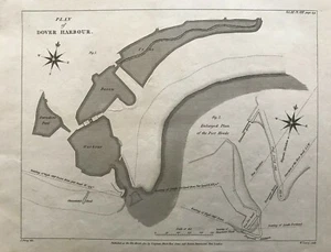
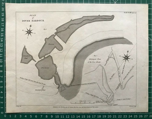
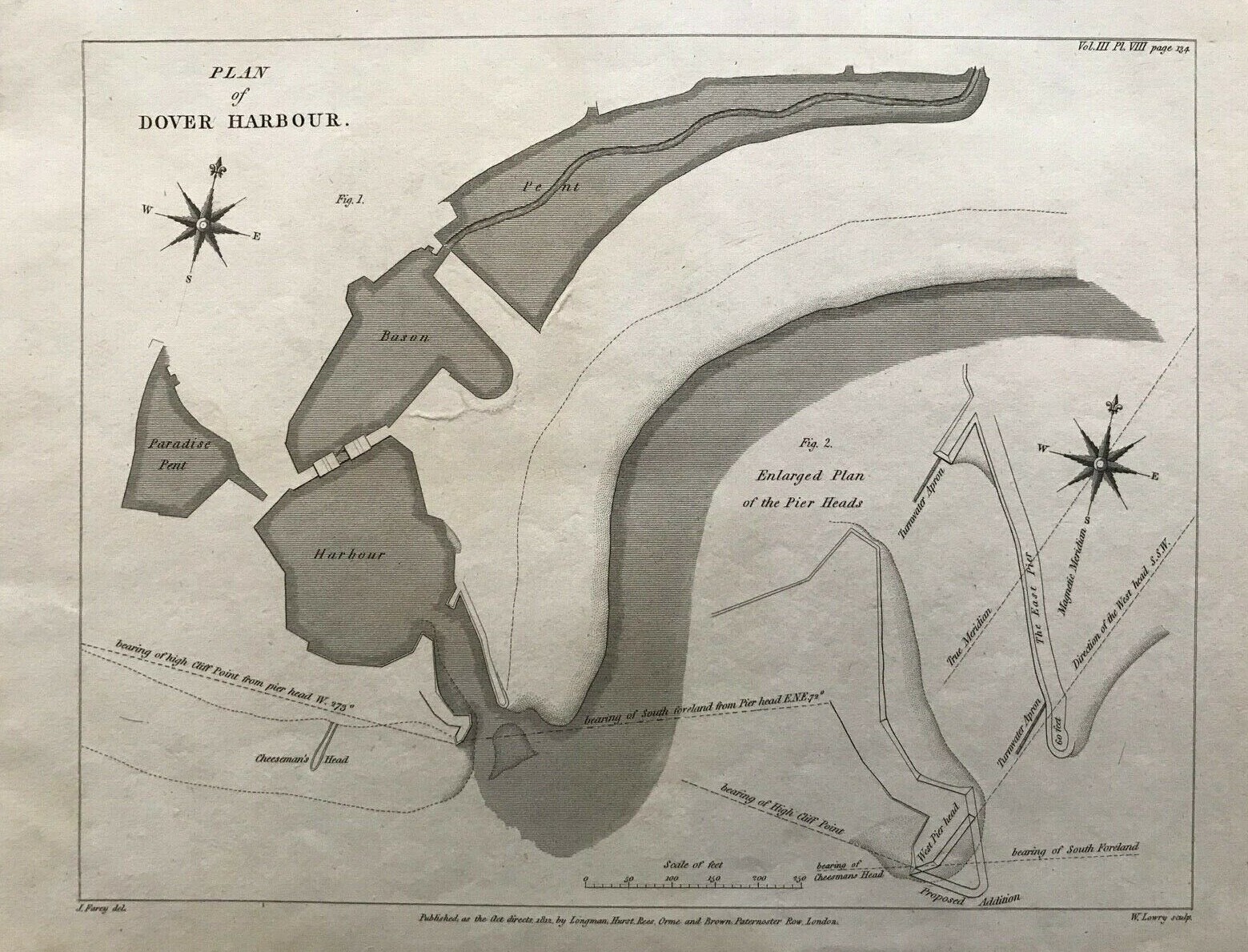
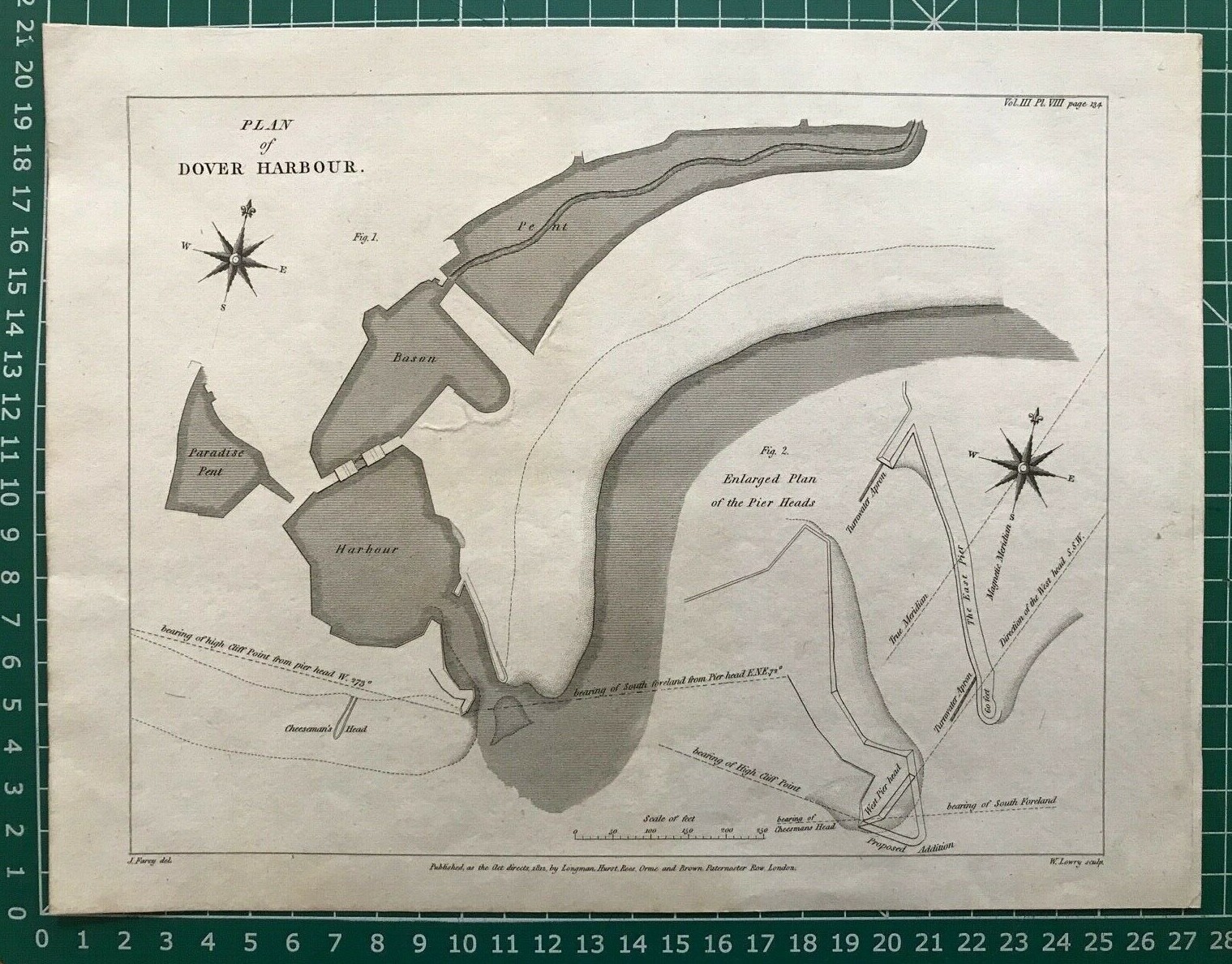
1812 Antique Map; Plan of Dover Harbour, Kent by John Farey

GBP 24.99
ApproximatelyS$ 43.31
Condition:
“Good. Please check the scan for any blemishes prior to making your purchase. Virtually all ”... Read moreabout condition
Oops! Looks like we're having trouble connecting to our server.
Refresh your browser window to try again.
Shipping:
GBP 5.20 (approx S$ 9.01) Royal Mail International Standard.
Located in: Marlow, United Kingdom
Delivery:
Estimated between Sat, 16 Aug and Fri, 29 Aug to 94104
Returns:
30 days return. Buyer pays for return shipping. If you use an eBay shipping label, it will be deducted from your refund amount.
Coverage:
Read item description or contact seller for details. See all detailsSee all details on coverage
(Not eligible for eBay purchase protection programmes)
Shop with confidence
Seller assumes all responsibility for this listing.
eBay item number:294444503556
Item specifics
- Seller Notes
- County
- Kent
- Cartographer/Publisher
- John Farey Jr.
- Printing Technique
- Copper Plate
- Original/Reproduction
- Antique Original
- Format
- Atlas Map
- Type
- Physical Map
- Year
- 1812
- Antique
- Yes
- City
- Dover
- Date Range
- 1800-1899
- Country/Region
- England
- Era
- 1800s
Item description from the seller

Seller feedback (14,226)
- n***n (371)- Feedback left by buyer.Past monthVerified purchaseExcellent seller fast postage great products
- 0***b (2571)- Feedback left by buyer.Past monthVerified purchaseGreat service-many thanks Well packaged
- k***k (273)- Feedback left by buyer.Past monthVerified purchaseGood condition, strong packaging 👍