Picture 1 of 10


Gallery
Picture 1 of 10


Have one to sell?
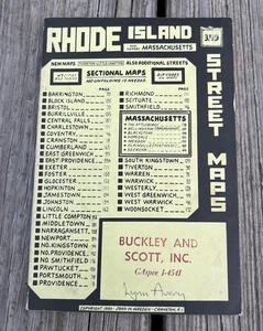
1980 Rhode Island Street Maps Atlas & Nearby Massachusetts Street Maps
US $29.95
ApproximatelyS$ 38.43
or Best Offer
Condition:
Oops! Looks like we're having trouble connecting to our server.
Refresh your browser window to try again.
Shipping:
US $5.38 (approx S$ 6.90) USPS Media MailTM.
Located in: North Adams, Massachusetts, United States
Delivery:
Estimated between Thu, 21 Aug and Mon, 25 Aug to 94104
Returns:
No returns accepted.
Coverage:
Read item description or contact seller for details. See all detailsSee all details on coverage
(Not eligible for eBay purchase protection programmes)
Seller assumes all responsibility for this listing.
eBay item number:277265171249
Item specifics
- Binding
- Softcover, Wraps
- Place of Publication
- Cranston, R.I.
- Subject
- History
- Original/Facsimile
- Original
- Year Printed
- 1980
- Language
- English
- Illustrator
- John W. Weeden
- Special Attributes
- Illustrated
- Region
- North America
- Personalized
- No
- Topic
- Street Atlas
- Country/Region of Manufacture
- United States
Item description from the seller
Seller feedback (4,439)
- t***c (804)- Feedback left by buyer.Past monthVerified purchaseGreat transaction. Thanks!
- o***s (278)- Feedback left by buyer.Past monthVerified purchaseGreat transaction. Item as described.
- f***s (110)- Feedback left by buyer.Past monthVerified purchaseThe book was very well wrapped, and the book itself was in awesome shape. Every bit as good as the advertising and a copy read. Thank you.