Picture 1 of 7


Gallery
Picture 1 of 7


Have one to sell?
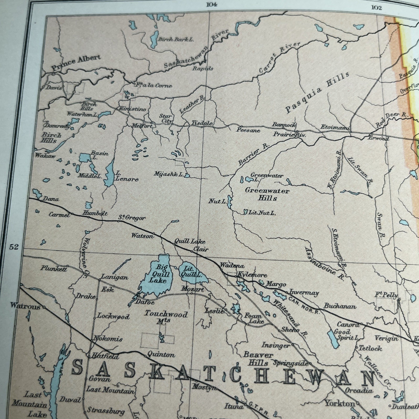
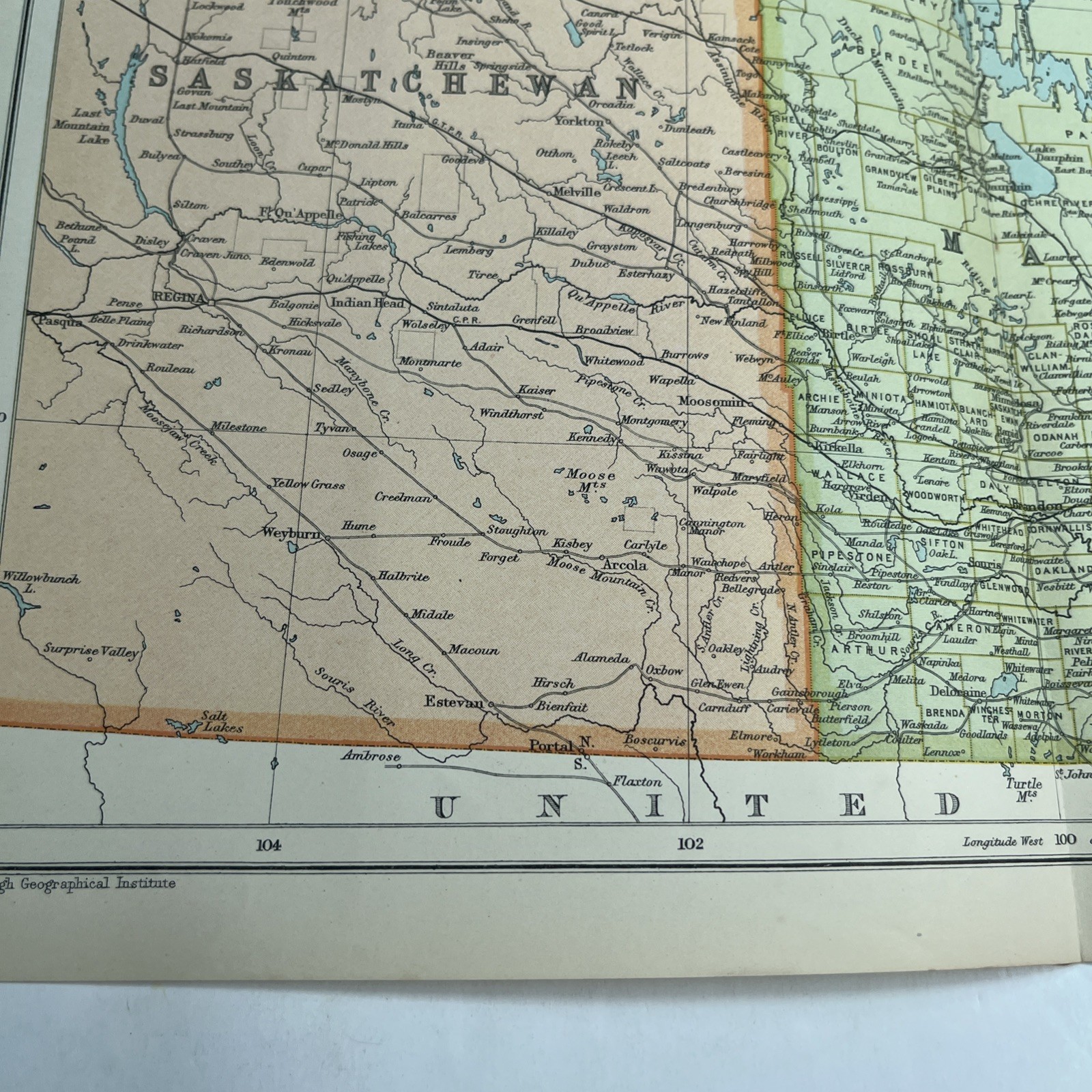
1910: Antique Map Of Manitoba Saskatchewan CS #65 Railway Atlas Antiquarian
GBP 19.95
ApproximatelyS$ 34.54
or Best Offer
Condition:
Oops! Looks like we're having trouble connecting to our server.
Refresh your browser window to try again.
Shipping:
Located in: Leicester, United Kingdom
Delivery:
Varies
Returns:
No returns accepted.
Coverage:
Read item description or contact seller for details. See all detailsSee all details on coverage
(Not eligible for eBay purchase protection programmes)
Seller assumes all responsibility for this listing.
eBay item number:277202473344
Item specifics
- Date Range
- 1910-1919
- Antique
- Yes
- Type
- Political Map
- Format
- Folding Map
- Printing Technique
- Lithography
- Year
- 1910
- Canadian Province
- Manitoba, Saskatchewan
- Era
- 1910s
- Original/Reproduction
- Antique Original
- Cartographer/Publisher
- John Bartholomew
Item description from the seller
Seller feedback (2,070)
- eBay automated Feedback- Feedback left by buyer.Past monthOrder completed successfully – tracked and on time
- eBay automated Feedback- Feedback left by buyer.Past monthOrder completed successfully – tracked and on time
- eBay automated Feedback- Feedback left by buyer.Past monthOrder completed successfully – tracked and on time