Picture 1 of 2


Gallery
Picture 1 of 2

Have one to sell?
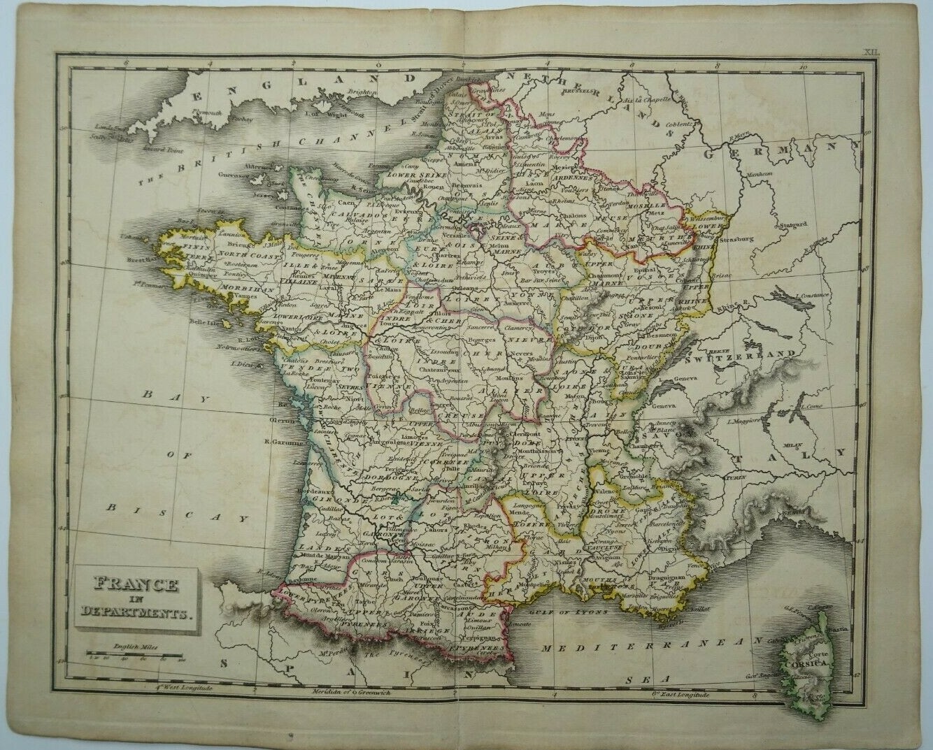
Antique map of France by John Russell 1825

GBP 15.99
ApproximatelyS$ 27.65
or Best Offer
Condition:
“Antique Original”
Oops! Looks like we're having trouble connecting to our server.
Refresh your browser window to try again.
Shipping:
GBP 12.00 (approx S$ 20.75) Royal Mail International Tracked.
Located in: Bath, United Kingdom
Delivery:
Estimated between Thu, 14 Aug and Fri, 22 Aug
Returns:
No returns accepted.
Coverage:
Read item description or contact seller for details. See all detailsSee all details on coverage
(Not eligible for eBay purchase protection programmes)
Seller assumes all responsibility for this listing.
eBay item number:254820517209
Item specifics
- Seller Notes
- “Antique Original”
- Antique
- Yes
- Date Range
- 1800-1899
- Type
- Topographical Map
- Printing Technique
- Lithography
- Format
- Atlas Map
- Year
- 1825
- Era
- 1800s
- Cartographer/Publisher
- John Russell
- Original/Reproduction
- Antique Original
- Country/Region
- France
Item description from the seller

Seller feedback (486)
- n***e (1751)- Feedback left by buyer.Past monthVerified purchaseTerrific seller! Lovely print, well packaged and quickly shipped. Thank you!!
- s***w (1149)- Feedback left by buyer.Past monthVerified purchaseExcellent - all fine thanks.
- l***k (7536)- Feedback left by buyer.Past monthVerified purchaseThanks again
This is a private listing and your identity will not be disclosed to anyone except the seller.
Seller feedback (486)
- n***e (1751)- Feedback left by buyer.Past monthVerified purchaseTerrific seller! Lovely print, well packaged and quickly shipped. Thank you!!
- s***w (1149)- Feedback left by buyer.Past monthVerified purchaseExcellent - all fine thanks.
- l***k (7536)- Feedback left by buyer.Past monthVerified purchaseThanks again