
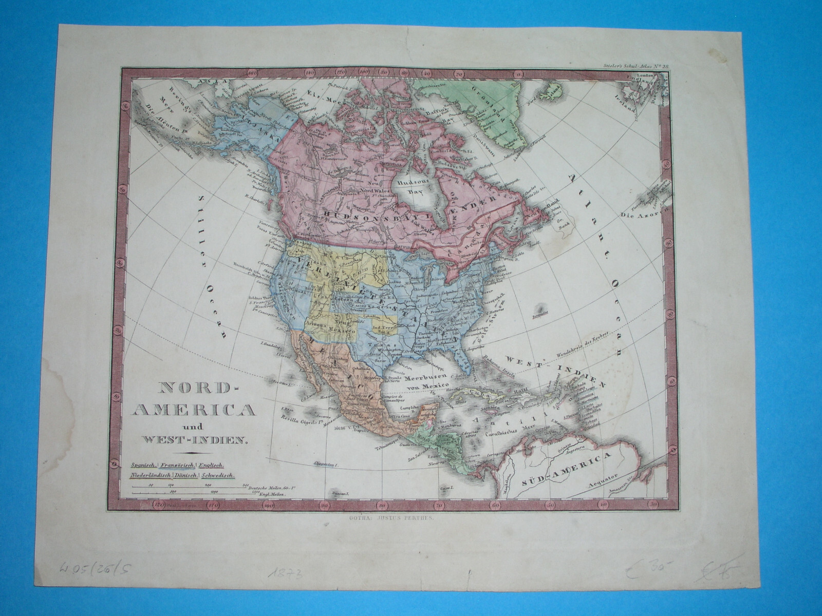
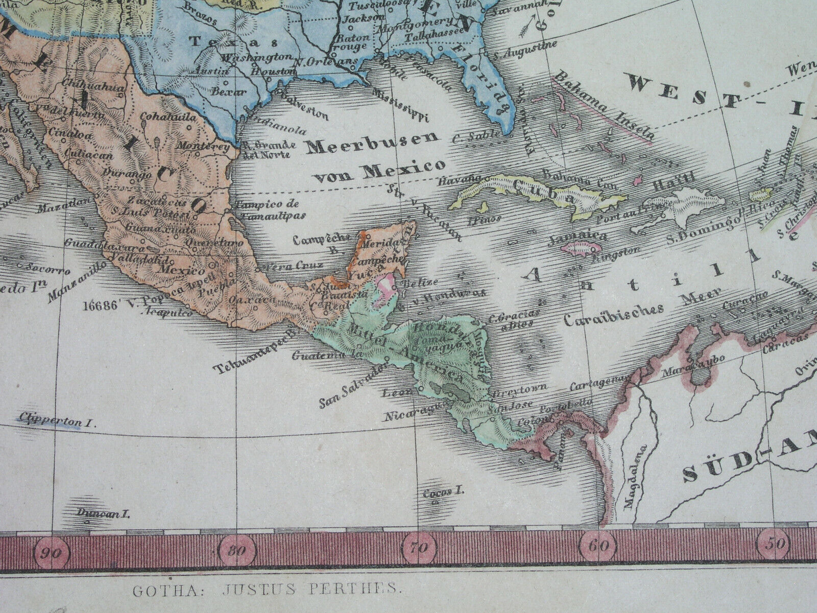
1873 ORIGINAL MAP TEXAS UNITED STATES CALIFORNIA IOWA FLORIDA CUBA MEXICO CANADA
US $47.49US $47.49
May 24, 06:11May 24, 06:11
Picture 1 of 8


Gallery
Picture 1 of 8


Have one to sell?
1873 ORIGINAL MAP TEXAS UNITED STATES CALIFORNIA IOWA FLORIDA CUBA MEXICO CANADA
Condition:
“SOME STAINS, SOME SCATTERED SPOTTING AND FOXING //// I INVITE YOU TO MY SHOP”
Ended: May 24, 2025 06:11:37 SGT
Oops! Looks like we're having trouble connecting to our server.
Refresh your browser window to try again.
Shipping:
US $16.00 (approx S$ 20.53) Economy Shipping from outside US.
Located in: Zary, Poland
Delivery:
Estimated between Fri, 22 Aug and Thu, 4 Sep to 94104
Returns:
No returns accepted.
Coverage:
Read item description or contact seller for details. See all detailsSee all details on coverage
(Not eligible for eBay purchase protection programmes)
Shop with confidence
Seller assumes all responsibility for this listing.
eBay item number:197315495469
Item specifics
- Seller Notes
- “SOME STAINS, SOME SCATTERED SPOTTING AND FOXING //// I INVITE YOU TO MY SHOP”
- Cartographer/Publisher
- Stieler / Stulpnagel / Perthes
- Mexican State
- Aguascalientes, Baja California, Baja California Sur, Campeche, Chiapas, Chihuahua, Coahuila, Colima, Durango, Guanajuato
- Printing Technique
- Copper Plate
- Original/Reproduction
- Antique Original
- Canadian Province
- Alberta, British Columbia, Manitoba, New Brunswick, Newfoundland & Labrador, Northwest Territories, Nova Scotia, Nunavut, Ontario, Prince Edward Island, Quebec, Saskatchewan, Yukon
- Format
- Atlas Map
- Type
- Political Map
- Year
- 1873
- US State
- AK, HI, AL, FL, GA, MS, NC, SC, Alabama, Alaska, AR, IA, KS, LA, MO, NE, Arizona, Arkansas, AZ, CA, CO, NM, NV, UT, California, Colorado, CT, MA, ME, NH, RI, VT, DC, DE, MD, NJ, NY, PA, New York, Oregon, Pennsylvania, Texas, Washington
- Date Range
- 1800-1899
- City
- Washington New York Mexico Montreal Havana
- Country/Region
- NORTH AMERICA / WEST INDIES / GUATEMALA
Item description from the seller
Seller Feedback
No feedback yet