Picture 1 of 6


Gallery
Picture 1 of 6


Have one to sell?
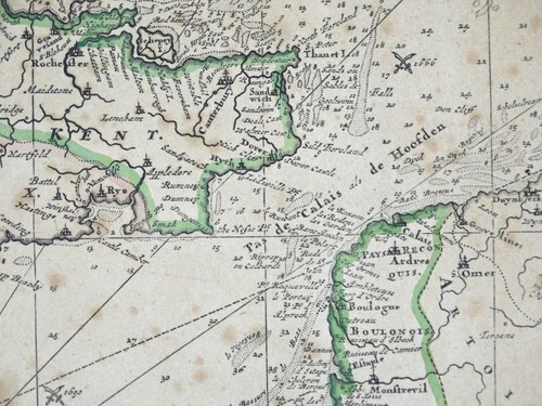
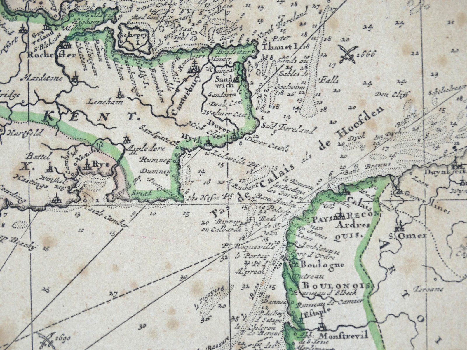
Antique Sea Chart ENGLISH CHANNEL original Theodore Danckerts nautical map c1695

GBP 195.00
ApproximatelyS$ 338.54
Condition:
“used”
Oops! Looks like we're having trouble connecting to our server.
Refresh your browser window to try again.
Shipping:
Does not ship to United States.
Located in: Shrewsbury, United Kingdom
Delivery:
Varies
Returns:
30 days return. Buyer pays for return shipping. If you use an eBay shipping label, it will be deducted from your refund amount.
Coverage:
Read item description or contact seller for details. See all detailsSee all details on coverage
(Not eligible for eBay purchase protection programmes)
Seller assumes all responsibility for this listing.
eBay item number:177031956625
Item specifics
- Seller Notes
- “used”
- Antique
- Yes
- Date Range
- 1600-1699
- Type
- Nautical Map
- Printing Technique
- Copper Plate
- Format
- Sea Chart
- Era
- 1600s
- Cartographer/Publisher
- Johannes Van Keulen
- Original/Reproduction
- Antique Original
- Country/Region
- United Kingdom
- County
- Kent
- Country/Region of Manufacture
- United Kingdom
Item description from the seller

Popular categories from this store
Seller feedback (19,059)
- d***3 (520)- Feedback left by buyer.Past monthVerified purchaseA very nice print. Thank you for quick delivery.
- Automatische feedback van eBay- Feedback left by buyer.Past monthBestelling op tijd geleverd zonder problemen
- Automatische feedback van eBay- Feedback left by buyer.Past monthBestelling op tijd geleverd zonder problemen