United States of America Wisconsin Antique North America Maps & Atlases 1800-1899 Date Range
235 Results
1843 Michigan Ohio Map DATED ORIGINAL Wisconsin Territory Iowa Great Lakes
S$ 114.88S$ 33.06 shipping1887 Original Antique Mitchell Map of Michagan and Wisconsin
S$ 27.91S$ 42.39 shippingOriginal 1864 WISCONSIN MICHIGAN-) Antique hand colored JOHNSON's MAP 26.5 X 18"
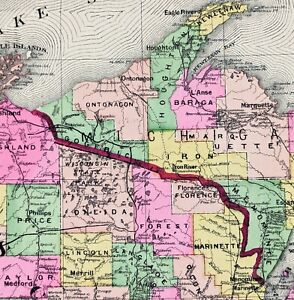
S$ 292.63S$ 65.35 shipping1897 WISCONSIN Map ORIGINAL Lake Superior Ashland Apostle Islands Menominee
S$ 71.99S$ 31.80 shippingNew Listing1865 ORIGINAL MAP ATLANTIC OCEAN UNITED STATES CANADA TEXAS EUROPE COMMUNICATION
S$ 81.060 bidsEnding 20 Jun at 6:14 SGT9d 8hS$ 23.56 shippingNew Listing1865 ORIGINAL MAP UNITED STATES TEXAS NEW YORK WASHINGTON FLORIDA PENNSYLVANIA
S$ 100.650 bidsEnding 20 Jun at 6:23 SGT9d 8hS$ 23.56 shipping1897 Map Western part of United States Original antique print USA
S$ 6.94S$ 10.31 shipping1882 RARE ORIGINAL MAP UNITED STATES GEORGIA OHIO MICHIGAN NEW YORK FLORIDA IOWA
S$ 114.840 bidsEnding Friday at 6:25 SGT3d 8hS$ 26.51 shippingNew Listing1895 Large 15"x22" Rand McNally Atlas Map ~ MILWAUKEE, WISCONSIN ~ Free S&H
S$ 37.830 bidsS$ 44.51 shippingEnding Saturday at 4:17 SGT4d 6h1843 UNITED STATES Map Iowa Territory Texas Republic Large Wisconsin ORIGINAL
S$ 169.37S$ 34.68 shippingBeautiful Old 1888 Cram Atlas County & Railroad Map ~ WISCONSIN ~ (XL17x23) #573
S$ 67.68Was: S$ 71.99S$ 28.73 shipping1840 United States antique map by Greenleaf - 14.2" x 12" scarce 1st edition
S$ 675.60S$ 60.34 shipping12 watching1899 Color Map Citys of Minneapolis & St. Paul Very Clean Detailed Near Mint Map
S$ 20.41S$ 52.02 shipping1898 Map of the State of WISCONSIN Hand Colored Lithograph 10.75 x 7.25
S$ 42.92S$ 45.22 shipping1896 Map of Illinois, Wisconsin, Iowa, Missouri, and Minnesota
S$ 58.84S$ 36.01 shipping1943 Vintage Map - The United States on March 4, 1861 - The Civil War
S$ 19.15S$ 42.21 shippingMINNESOTA, MICHIGAN, LAKE SUPERIOR, FISH Antique authentic nautical map 1891
S$ 91.31S$ 55.36 shipping1889 WISCONSIN Map ORIGINAL Green Bay Madison Upper Peninsula Keweenaw Milwaukee
S$ 51.350 bidsEnding Wednesday at 8:30 SGT1d 10hS$ 31.33 shippingVintage 1878 BUFFALO COUNTY WISCONSIN Map 14"x17" ~ Old Antique Original MONDOVI
S$ 68.87Was: S$ 95.66S$ 31.71 shipping1899 Plat Map City of Mazomanie or Oregon Dane County Wisconsin
S$ 25.77S$ 43.65 shipping1889 Railroad Map ~ WISCONSIN ~ Authentic McNally Map (XLG20x28) #041
S$ 45.940 bidsS$ 28.73 shippingEnding Thursday at 5:10 SGT2d 7h1890 Plat Map KEKOSKEE, DANVILLE, DODGE Co., WISCONSIN / ASHIPPUN Co. on Reverse
S$ 67.68Was: S$ 71.99S$ 28.73 shipping1840 GREEN BAY WISCONSIN Map ORIGINAL Astor Lake Michigan Survey RARE
S$ 132.55S$ 38.19 shipping1892 Stieler Map North South Dakota Nebraska Minnesota Iowa United States Canada
S$ 44.17S$ 29.44 shipping1890 Plat Map ~ HUSTISFORD Twp., DODGE Co., WISCONSIN / CLYMAN Co. on Reverse
S$ 67.68Was: S$ 71.99S$ 28.73 shippingWAUPUN WISCONSIN 1870s Antique Map Framed Plat Of Township Rare Mint
S$ 368.19S$ 169.51 shipping1881 McNally Railroad Map Wisconsin Madison Milwaukee Green Bay Apostle Islands
S$ 51.53S$ 29.44 shippingAntique 1878 Map ~ BEAVER DAM - WAPUN - FOX LAKE - TOMAH, WISCONSIN ~ Authentic
S$ 63.61Was: S$ 67.68S$ 28.73 shippingAntique State of MInnesota Map 1899 Atlas Wisconsin flip multicolored
S$ 36.75S$ 54.35 shipping1899 WISCONSIN Map ORIGINAL Green Bay Madison Superior Milwaukee ATLAS MAP
S$ 36.64S$ 45.14 shipping1895 Detroit City & Wisconsin State Colored Atlas World Map Rand McNally Vintage
S$ 73.61S$ 46.23 shipping1845 WISCONSIN TERRITORY Map Carver's Grant Green Bay Madison H.S. TANNER
S$ 641.82S$ 59.34 shippingOriginal 1885 Antique Map WISCONSIN Madison Kenosha Waukesha Appleton Green Bay
S$ 61.86S$ 45.88 shipping1880 RARE NICE ORIGINAL ENGRAVING MILWAUKEE WISCONSIN panoramic city view
S$ 36.81S$ 20.62 shipping1890 Plat Map ~ LOMIRA, DODGE Co., WISCONSIN / OAK GROVE, IRON RIDGE on Reverse
S$ 67.68Was: S$ 71.99S$ 28.73 shipping1884 Rand McNally Map - Wisconsin - Madison Milwaukee Green Bay Apostle Islands
S$ 18.40S$ 29.44 shippingAntique 1878 Map ~ OUTAGAMIE Co. - APPLETON, WISCONSIN ~ Old Authentic Ancestry
S$ 63.61Was: S$ 67.68S$ 28.73 shippingOld 1873 Plat Map ~ HORICON Twp., DODGE Co., WISCONSIN - ROCK RIVER
S$ 67.68Was: S$ 71.99S$ 28.73 shipping1891 Cram Map - Michigan Wisconsin Lansing Detroit Madison Milwaukee Kalamazoo
S$ 36.81S$ 29.44 shipping1873 Mitchell's Atlas Map Michigan and Wisconsin Authentic Hand-Colored 12 x 16"
S$ 147.28S$ 66.00 shipping1874 Michigan Wisconsin Mitchell antique map ~23.7" x 15.2" rare Ziegler McCurdy
S$ 145.81S$ 60.13 shipping1899 Color Map States of Wisconsin & Minnesota Very Clean Detailed Near Mint Map
S$ 20.41S$ 52.02 shippingAntique 1878 Map ~ BARRON Co. ASHLAND - MENOMONI, WISCONSIN ~ Authentic Ancestry
S$ 67.68Was: S$ 71.99S$ 28.73 shippingantique map Michigan and Wisconsin and U.P. 1852 Mitchell's Maps
S$ 29.44S$ 56.33 shippingOld Antique 1895 Plat Map ~ CITY of RIVER FALLS, PIERCE Co., WISCONSIN Free S&H
S$ 63.61Was: S$ 67.68S$ 28.73 shippingWISCONSIN, LAKE MICHIGAN, POUND NETS, FISH Antique authentic nautical map 1891
S$ 95.73S$ 55.50 shipping1898 Rand McNally Atlas 14"x21" Map of Milwaukee WI original from Atlas VG
S$ 17.67S$ 42.17 shippingOld 1890 Plat Map NEOSHO Twp., DODGE Co., WISCONSIN / THERESA Twp. on Reverse
S$ 67.68Was: S$ 71.99S$ 28.73 shipping1898 Mathews Northrup Map Wisconsin Madison Milwaukee Green Bay Superior 14x22
S$ 36.81S$ 29.44 shipping1890 Plat Map ~ City of HORICON, DODGE Co., WISCONSIN / BURNETT Co. on Reverse
S$ 67.68Was: S$ 71.99S$ 28.73 shipping1885 Antique Atlas Map / OHIO, MICHIGAN, ILLINOIS, INDIANA, WISCONSIN
S$ 36.81S$ 35.36 shipping1888 Color County Double page Map of Michigan & Wisconsin see title page picture
S$ 20.41S$ 52.02 shippingOld 1890 Plat Map ~ CITY of BEAVER DAM (SOUTH), DODGE Co., WISCONSIN (Lg17x28)
S$ 67.68Was: S$ 71.99S$ 28.73 shipping1890 Colored County Wisconsin Map w/ Michigan on Reverse, 14 1/8" x 10 7/8"
S$ 27.98S$ 50.99 shipping1856 Wisconsin & MN Survey Antique Map Lithograph - Ackerman NY ~ 21.5" x 18.7"
S$ 110.46S$ 56.14 shipping1884 Cram's Atlas, County & Railroad Map ~ WISCONSIN - MICHIGAN ~ Free S&H
S$ 67.68Was: S$ 71.99S$ 28.73 shipping1886 Tunison Map Wisconsin Upper Michigan Madison Eau Claire Hayward Marquette
S$ 73.63S$ 29.44 shippingOld 1873 Plat Map ~ EMMET Twp., DODGE Co., WISCONSIN - WATERTOWN ~ Free S&H
S$ 67.68Was: S$ 71.99S$ 28.73 shipping1865 Wisconsin & Michigan by Johnson Ward - beautiful antique map 26.5" x 18"
S$ 176.74S$ 65.10 shipping1895 Original Color Map Wisconsin and Minnesota Historic 11 x 14 Map
S$ 27.54S$ 44.86 shipping