United Kingdom 1800-1899 Date Range Antique Europe Physical Maps
50 Results
Antique Map "A New Map of the Isle of Wight" George Brannon, 1824
S$ 404.63S$ 30.99 shippingOriginal classroom Physical & Economic Map of The British Isles hard roll ~ Trl7
S$ 32.22Was: S$ 44.12S$ 199.03 shipping1812 Lapie Map of Great Britian Scotland and Ireland
S$ 146.10S$ 80.47 shippingMAP GB ENGLAND & WALES 1879 embossed map from Plastic School Atlas 29,5cmx24,5cm
S$ 82.58S$ 16.80 shipping1855 Antique Map: Plan of the City of Syracuse Besieged by the Athenians, Sicily
S$ 24.38S$ 9.76 shipping1855 Antique map: The World as known to the ancients by Robert Scott
S$ 28.13S$ 9.76 shipping1855 Antique map: The Carthaginian Empire in Africa by R. Scott
S$ 28.13S$ 9.76 shipping1855 Antique map: Greece & Northern Provinces near the Danube by R. Scott
S$ 28.13S$ 9.76 shipping1855 Antique map: The Expedition of Hannibal into Italy by R. Scott
S$ 28.13S$ 9.76 shipping1839 Stieler Physical Map Europe River Basins Mountain Ranges Rhine Danube Seine
S$ 59.02Was: S$ 73.77S$ 29.50 shipping1855 Antique map: Egypt with Libya by R. Scott
S$ 28.13S$ 9.76 shippingc.1885 Antique Map of Physical Features and Comparative Heights of Mountains
S$ 17.220 bidsS$ 32.78 shippingEnding Wednesday at 20:49 SGT1d 5hMAP IRELAND 1820 superb 200 years old handcoloured map 20cm x 25,5cm C.Brightly
S$ 69.44S$ 16.80 shippingMAP GB SCOTLAND 1879 embossed map from the Plastic School Atlas 29,5cmx24,5cm
S$ 82.58S$ 16.80 shippingMAP IRELAND 1879 embossed map from the Plastic School Atlas 29,5cmx24,5cm
S$ 82.58S$ 16.80 shippingMAP IRELAND 1879 embossed map from the Plastic School Atlas 29,5cmx24,5cm
S$ 82.58S$ 16.80 shipping1855 Antique Map: Expedition of Cyrus the Younger and the retreat by R. Scott
S$ 28.13S$ 9.76 shippingOriginal Antique Map Jersey Channel Islands 1849 9.25" x 7"
S$ 112.61S$ 30.03 shipping1855 Antique map: Asia Minor & the Euxine / Black Sea by R. Scott
S$ 28.13S$ 9.76 shippingANTIQUE COLOUR MAP BRITISH ISLES PHYSICAL MAP 1878
S$ 34.72S$ 7.51 shippingAntique Map The British Isles Physical Map Virtue & Co Ltd 1885
S$ 56.30S$ 25.34 shippingANTIQUE 1809 MAP ENGLAND & WALES CADELL DAVIES STRAND LONGMAN HURST REES ORME
S$ 233.09S$ 74.41 shipping1876 British Isles antique map ~ 27.5" x 19.6" hand colored - Scotland & Ireland
S$ 110.68S$ 58.47 shippingAntique Coloured Framed Print “Map of the Isle of Wight" Alfred Brannon, 1862
S$ 137.75S$ 64.19 shippingOriginal 1884 Physical & Economic Map of The British Isles by Drioux & Leroy
S$ 29.52S$ 35.21 shipping1876 British Isles map antique ~ 17.3" x 13.8" hand color & US Census maps
S$ 36.89S$ 52.61 shipping1875 Lange Map - British Isles - England Wales Scotland Ireland London Dublin UK
S$ 29.50Was: S$ 36.88S$ 29.50 shipping1864 Delamarche Map - Physical Europe France Spain Germany Italy Britain Russia
S$ 29.50Was: S$ 36.88S$ 29.50 shipping1843 Woodbridge Physical Map Europe France Spain Germany Italy Sweden Austria UK
S$ 29.50Was: S$ 36.88S$ 29.50 shippingc 1860 Ansart Map Physical Europe Continental Divide River Basins Alps Pyrenees
S$ 47.21Was: S$ 59.02S$ 29.50 shipping1843 Woodbridge Map Europe France Spain Germany Italy Sweden Norway Austria UK
S$ 29.50Was: S$ 36.88S$ 29.50 shipping1897 MAP Baedeker - UNITED KINGDOM Wales Bristol Channel Shore Ilfracombe etc
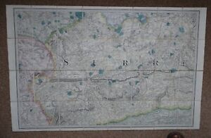
S$ 21.40S$ 19.18 shippingOS 1" Map - Sheet 8 Surrey 1876
S$ 51.65S$ 46.70 shipping1820 Europe Iberia to Russia antique map by Lavoisne ~ 21.8" x 17.4" hand color
S$ 110.68S$ 47.93 shipping1875 Lange Physical Map - British Isles - England Wales Scotland Ireland London
S$ 23.60Was: S$ 29.50S$ 29.50 shipping1897 BAEDEKER MAP - WALES between Bangor & Tremadog
S$ 31.04S$ 19.18 shipping1840 Europe map by Greenleaf 14.2" x 11.9" scarce 1st edition antique
S$ 146.10S$ 48.98 shipping1876 Europe antique map ~ 27.5" x 19.5" hand colored - large - ships
S$ 110.68S$ 58.47 shipping1897 BAEDEKER MAP - UNITED KINGDOM Wales Conway, Betws-y-Coed & Environs
S$ 21.40S$ 19.18 shipping1897 BAEDEKER MAP - WALES Wye River Ross Chepstow + Gloucester Cathedral Plan
S$ 21.40S$ 19.18 shipping1897 BAEDEKER MAP - ENGLAND Portsmouth City Plan & Chichester Cathedral Plan
S$ 21.40S$ 19.18 shipping1897 BAEDEKER MAP - ENGLAND Worcester City Plan + Cathedral Ground Plan
S$ 21.40S$ 19.18 shipping1820 Europe Barbarian Incursion antique map by Lavoisne 21.8" x 17.6" hand color
S$ 110.68S$ 47.93 shipping1897 BAEDEKER MAP - UNITED KINGDON Isle of Wight & Dorking Guildford Environs
S$ 21.40S$ 19.18 shippingIRELAND 1841 MAP - 8 x 10.5" (20 x 26 cm) Engraving Intaglio
S$ 23.61S$ 19.18 shipping1897 BAEDEKER MAP - ENGLAND Warwick & Environs + Plan of Kenilworth Castle
S$ 21.40S$ 19.18 shipping1897 BAEDEKER MAP - ENGLAND Peak District National Park Hartington
S$ 21.40S$ 19.18 shippingPhysical map of British Isles and North Sea By JGB Bartholomew,Macmillan & Co
S$ 46.90S$ 16.89 shippingPhysical Map of Asia, 1981, By JGB Bartholomew, Macmillan & Co, London. 1891
S$ 46.90S$ 16.89 shippingMap Southern England Weekly Dispatch Atlas by Weller c1869
S$ 66.41S$ 36.89 shipping