Antique Original Antique Ordnance Survey Maps
1,363 Results
Bartholomew's Reduced Survey LOT 24 Cloth Maps Tourists & Cyclists, England & UK
S$ 134.51Was: S$ 269.02S$ 172.84 shippingAntique Ordnance Survey Folding Map Early 1900s - Scarborough, England Sheet 23
S$ 8.06Was: S$ 16.13S$ 52.52 shippingAntique Ordnance Survey Folding Map Early 1900s - England & Whales Sheet 45
S$ 8.06Was: S$ 16.13S$ 52.52 shippingAntique Ordnance Survey Folding Map Early 1900s - Winchester, England Sheet 124
S$ 8.06Was: S$ 16.13S$ 52.52 shippingAntique Ordnance Survey Folding Map Early 1900s - England & Whales Sheet 27
S$ 8.06Was: S$ 16.13S$ 52.52 shippingAntique Ordnance Survey Folding Map Early 1900s - England & Whales Sheet 20
S$ 8.06Was: S$ 16.13S$ 52.52 shippingAntique Ordnance Survey Folding Map Early 1900s - England & Whales Sheet 25
S$ 8.06Was: S$ 16.13S$ 52.52 shippingAntique Ordnance Survey Folding Map Early 1900s - Sheffield, England Sheet 37
S$ 8.06Was: S$ 16.13S$ 52.52 shippingAntique Ordnance Survey Folding Map Early 1900s - England & Whales Sheet 33
S$ 8.06Was: S$ 16.13S$ 52.52 shippingAntique Ordnance Survey Folding Map Early 1900s - England & Whales Sheet 53
S$ 8.06Was: S$ 16.13S$ 52.52 shippingAntique Ordnance Survey Folding Map Early 1900s - Bradford, England Sheet 69
S$ 8.06Was: S$ 16.13S$ 52.52 shippingBartholomew's 4 Miles to the Inch Map, Sheet 12: Surrey, Sussex & Kent (ca 1900)
S$ 48.43S$ 53.81 shippingAntique Ordnance Survey Folding Map Early 1900s - Warwick, England Sheet 184
S$ 8.06Was: S$ 16.13S$ 52.52 shippingAntique Ordnance Survey Folding Map Early 1900s - Andover, England Sheet 283
S$ 7.52Was: S$ 15.06S$ 52.52 shippingBeautiful 1905 Color GEOLOGIC MAP OF JUNEAU VICINITY, ALASKA, 18” X 21.5”
S$ 43.96S$ 30.88 shippingOrdnance Survey one inch Tourist map of Exmoor Forest. 1921.
S$ 6.850 bidsS$ 30.00 shippingEnding 30 May at 2:34 SGT7d 2h1920 Ordnance Survey Ipswich Vintage Map CLOTH PANELS
S$ 20.52S$ 9.34 shippingOrdnance Survey 3rd edition 1 inch map of Knighton Sheet 70. 1912
S$ 6.770 bidsS$ 30.00 shippingEnding 30 May at 2:33 SGT7d 2hOrdnance Survey 3rd edition 1 inch map Hunstanton & Fakenham, Sheet 57. 1910
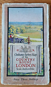
S$ 7.711 bidS$ 30.05 shippingEnding 30 May at 2:25 SGT7d 2hOrdnance Survey one inch Tourist map of Country Round London. 1921.
S$ 8.140 bidsS$ 30.08 shippingEnding 30 May at 2:47 SGT7d 3hOrdnance Survey one inch 3rd Edition (LSS) map of Marlborough. Sheet 113. 1908.
S$ 7.203 bidsS$ 29.35 shippingEnding 30 May at 2:14 SGT7d 2hOrdnance Survey one inch Tourist map of Cheltenham & District. 1922.
S$ 6.420 bidsEnding 30 May at 2:39 SGT7d 2hS$ 29.30 shipping1912 LONDONDERRY N. Ireland - Ordnance Survey Cloth Map - Sheet #1
S$ 8.57S$ 30.44 shippingOrdnance Survey 3rd edition 1 inch map of Warwick & Banbury, Sheet 83. 1909.
S$ 9.422 bidsS$ 30.15 shippingEnding 30 May at 2:23 SGT7d 2hOrdnance Survey one inch 3rd edition (LSS) map of Bristol, Sheet 112. 1907.
S$ 7.200 bidsS$ 29.35 shippingEnding 30 May at 2:16 SGT7d 2h1905 Claremorris Vintage Ordnance Survey White Cover Cloth Map - Co Mayo Ireland
S$ 25.70S$ 31.37 shippingOrdnance Survey 3rd edition 1 inch map of Lampeter, Sheet 79. 1912
S$ 7.710 bidsS$ 29.36 shippingEnding 30 May at 2:31 SGT7d 2hOrdnance Survey one inch 3rd edition map of Shoeburyness, Sheet 109. 1908.
S$ 6.420 bidsS$ 29.30 shippingEnding 30 May at 2:18 SGT7d 2hOrdnance Survey one inch map of Southampton and Portsmouth. Sheet 135. 1908
S$ 7.801 bidS$ 29.36 shippingEnding 30 May at 2:11 SGT7d 2hOrdnance Survey one inch 3rd edition map of Rickmansworth, Sheet 107. 1908.
S$ 5.142 bidsS$ 29.23 shippingEnding 30 May at 2:19 SGT7d 2hOrdnance Survey one inch Popular Edition map of Cromer, Sheet 58. 1922
S$ 4.280 bidsS$ 29.86 shippingEnding 28 May at 3:19 SGT5d 3hOrdnance Survey one inch 3rd edition (LSS) map of Guildford. Sheet 125. 1909
S$ 8.480 bidsS$ 29.42 shippingEnding 30 May at 2:09 SGT7d 2hAntique Ordnance Survey Map Kenmare Ireland Sheet #184 I Inch To 1 Mile 1903
S$ 51.340 bidsS$ 15.82 shippingEnding Saturday at 4:15 SGT2d 4hOrdnance Survey one inch 3rd edition map of Buckingham & Luton, Sheet 96. 1907.
S$ 5.140 bidsS$ 29.91 shippingEnding 30 May at 2:21 SGT7d 2hOrdnance Survey one inch map of Croydon, Gravesend & Sevenoaks. Sheet 116. 1909
S$ 5.570 bidsS$ 29.93 shippingEnding 30 May at 2:13 SGT7d 2hOrdnance Survey 3rd edition 1 inch map of Skipton, Sheet 25. 1913
S$ 7.200 bidsS$ 30.03 shippingEnding 30 May at 2:29 SGT7d 2hBeautiful 1905 Color GEOLOGIC MAP OF THE JUNEAU GOLD BELT, ALASKA, 19” X 55”
S$ 73.32S$ 31.75 shippingAntique Map Pembroke On Cloth Dated 1952 Ordnance Survey National Grid
S$ 14.92S$ 9.24 shippingOrdnance Survey half inch layered map Portsmouth & Isle of Wight Sheet 38. 1914
S$ 22.41S$ 22.41 shippingOrdnance Survey one inch 3rd edition map of Clovelly & Bude. Sheet 129. 1910
S$ 7.710 bidsS$ 29.88 shippingEnding 30 May at 2:12 SGT7d 2hOrdnance Survey one inch Popular Edition map of Wolverhampton, Sheet 61. 1921
S$ 5.650 bidsS$ 29.26 shippingEnding 28 May at 3:21 SGT5d 3hAntique Map Dated 1955 On Cloth Barrow In Furness Ordnance Survey National Grid
S$ 16.79S$ 9.24 shippingLondon N.W Map Dated 1947 Vintage On Cloth Ordnance Survey One Inch Map
S$ 35.46S$ 9.24 shipping1891 ILLINOIS & MISSISSIPPI CANAL MAP, Rock River at Milan, Illinois, 19” X 28”
S$ 43.96S$ 33.27 shippingBeautiful 1905 Color TOPOGRAPHIC MAP OF THE JUNEAU GOLD BELT, ALASKA, 19” X 55”
S$ 73.32S$ 31.75 shipping1906 BALLINROBE Vintage Ordnance Survey Cloth Map Co. Mayo Ireland
S$ 25.70S$ 31.37 shippingc1920s Ordnance Survey 10 Mile Map of Great Britain - Sheets 1 2 & 3 Linen
S$ 25.70S$ 42.44 shippingOrdnance Survey one inch map of Buckingham. Sheet 96. 1907
S$ 8.480 bidsS$ 29.42 shippingEnding 28 May at 3:24 SGT5d 3hHAMPSHIRE NORTH BY WILLIAM MUDGE c1817 GENUINE 1st EDITION ORDNANCE SURVEY MAP
S$ 224.09S$ 14.94 shippingISLE OF WIGHT BY WILLIAM MUDGE c1810 GENUINE 1st EDITION ORDNANCE SURVEY MAP
S$ 280.11S$ 14.94 shippingHAMPSHIRE SOUTH BY WILLIAM MUDGE c1810 GENUINE 1st EDITION ORDNANCE SURVEY MAP
S$ 364.14S$ 14.94 shippingOriginal 1899 OS Map Sheet Carshalton Sutton Wallington LB&SCR Hackbridge Cheam
S$ 117.57S$ 10.85 shippingWELWYN GARDEN CITY Ordnance Survey 2½ Inch Map - 1:25000 Scale - 1962
S$ 6.54S$ 9.34 shippingHADRIAN'S WALL . ORDNANCE SURVEY 2 Inches to 1 Mile. VGC
S$ 2.80S$ 12.60 shipping1911 Linen Back OS Map Cheshire Sheet XXXV S.E. 6" to 1 Mile, Old Withington Etc
S$ 20.56S$ 35.38 shippingAntique Ordnance Survey Map - The Campo Of Gibraltar - 1912
S$ 428.30S$ 69.73 shippingOrdnance Survey Map of Nottingham Sheet 54 1912 Coloured Edition
S$ 26.14S$ 22.41 shippingKENT MAIDSTONE BY WILLIAM MUDGE c1819 GENUINE 1st EDITION ORDNANCE SURVEY MAP
S$ 270.77S$ 14.94 shippingOS MAP SHEET 137 1" to a Mile Brighton, Eastbourne & Lewes c.1900's
S$ 32.53S$ 27.45 shippingOriginal 1915 Plat Map City West Bend Wis Bottling Works Railroad Canning Gehl
S$ 33.03S$ 44.68 shipping