Antique Original Antique Maps, Atlases & Globes
2,365 Results
NAUTICAL ENGRAVED MULTIPLE RING HEAVY BRASS ARMILLARY GLOBE LION STYLE SPHERE
S$ 301.71Free postageLarge Engraved 18 Inches Brass Armillary Sphere Lion World Globe and Sundial Gif
S$ 295.48Free postageAntique Map Of The Malabar Coast By Baldaeus (1744) Canara Decan Old Collectible
S$ 813.05Free postageBartholomew's Reduced Survey LOT 24 Cloth Maps Tourists & Cyclists, England & UK
S$ 270.49S$ 174.90 shipping1779 Map of England by T Bowen
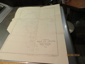
S$ 44.670 bidsEnding Today at 6:53 SGT4h 20mS$ 27.05 shippingSKETCH MAP OF INDIA 1854, ILLUSTRADING THE LINES OF ELECTRIC TELEGRAPH # 243
S$ 43.27S$ 3.25 shippingNEW MAP OF WINDSOR ONTARIO, CANADA, METROPOLITAIN AREA 1959
S$ 10.81S$ 3.25 shippingAntique map. THE WORLD SHIPPING TRAFFIC MAP. 1886
S$ 16.23S$ 17.29 shippingNORTH AMERICA. CANADA & ALASKA. Antique map Circa 1880
S$ 16.23S$ 17.29 shippingQuebec, anno 1705, N. de Fer-ORIGINAL COPPERENGRAVING---
S$ 794.12Free postageVancouver, G. Voyage de découvertes, à l'Océan Pacifique du Nord anno 1799/1800
S$ 32,757.43Free postageAntique map. THE WORLD PHYSICAL MAP. Circa 1885
S$ 16.23S$ 17.29 shippingAntique map. EUROPE. LANGUAGE, ETHNIC MAP OF EUROPE. Circa 1885
S$ 16.23S$ 17.29 shippingAntique Ordnance Survey Folding Map Early 1900s - Sheffield, England Sheet 37
S$ 16.22S$ 53.15 shippingAntique Ordnance Survey Folding Map Early 1900s - Winchester, England Sheet 124
S$ 16.22S$ 53.15 shippingAntique Brass World Globe Armillary Huge Base Compass Home Decorative Working
S$ 271.45Free postageSOUTH EUROPE. SEA ROUTES OF MEDITERRANEAN SEA. Antique big size map. 1898
S$ 37.87S$ 17.29 shippingVintage Philips Railway Map of the British Isles by George Philip Son Ltd c1930
S$ 32.13S$ 19.26 shippingAntique map. GERMANY. POPULATION DENSITY MAP OF GERMANY. 1886
S$ 16.23S$ 17.29 shippingAntique map. EUROPE. PHYSICAL MAP OF EUROPE. Circa 1885
S$ 10.82S$ 17.29 shippingAntique map. GERMANY. DISTRIBUTION OF THE JEWS IN GERMANY & RELIGION MAP. 1886
S$ 16.23S$ 17.29 shippingVery large 1913 Manitoba Map 3’5” X 2’8”
S$ 496.32S$ 21.84 shippingIllinois Railroad 1888 Map + Iowa/Dakota Promotional Material for Home Seekers
S$ 689.89S$ 24.06 shippingHALIFAX to SOUTH OWRAM Original Circa 1802-1830 Survey plan, Market Place, Gas W
S$ 512.29S$ 13.66 shippingAntique map. THE WORLD LANGUAGE MAP. Circa 1905
S$ 16.23S$ 17.29 shipping1700, A NEW MAP OF THE TERRAQUEOUS GLOBE, ATLANTIS, CALIFORNIA AS AN ISLAND
S$ 4,433.85S$ 129.40 shippingAntique map. THE WORLD MAP OF DISTRIBUTION OF FISHES AMPHIBIANS REPTILES. c 1905
S$ 8.66S$ 14.14 shippingAntique map. THE WORLD STATE FORMS. Circa 1905
S$ 8.66S$ 14.14 shippingAntique Ordnance Survey Folding Map Early 1900s - Bradford, England Sheet 69
S$ 16.22S$ 53.15 shippingAntique Ordnance Survey Folding Map Early 1900s - England & Whales Sheet 53
S$ 16.22S$ 53.15 shippingAntique Ordnance Survey Folding Map Early 1900s - England & Whales Sheet 45
S$ 16.22S$ 53.15 shippingAntique Ordnance Survey Folding Map Early 1900s - England & Whales Sheet 27
S$ 16.22S$ 53.15 shippingAntique map. THE WORLD AGRICULTURAL ZONES. Circa 1905
S$ 8.66S$ 14.14 shippingAntique map. GERMANY. MAGNETIC MAP OF GERMANY. c 1905
S$ 8.66S$ 14.14 shippingAntique map. GEOLOGICAL MAP. USABLE MINERALS IN RHINELAND & WESTPHALIA. c 1905
S$ 8.66S$ 14.14 shippingAntique map. THE WORLD MAP OF DISTRIBUTION OF WILD ANIMALS. c 1905
S$ 8.66S$ 14.14 shippingAntique map. THE WORLD MAP OF AIR PRESSURE & WIND DISTRIBUTION. c 1905
S$ 8.66S$ 14.14 shippingAntique map. THE WORLD REGIONS OF FAUNA. Circa 1905
S$ 8.66S$ 14.14 shippingAntique Ordnance Survey Folding Map Early 1900s - Warwick, England Sheet 184
S$ 16.22S$ 53.15 shippingAntique Map Regionum Choromandel, Golconda Et Orixa Nova Et Accurate Descriptio
S$ 813.05Free postageRAND, McNALLY 1909 MEXICO POCKET MAP-INDEXED STATE & RAILROADS & SHIPPERS GUIDE
S$ 57.09Free postageAntique map. GERMANY. MAP OF CRIMINAL STATISTICS. Circa 1905
S$ 8.66S$ 14.14 shippingAntique map. GERMANY. GLACIAL VALLEYS OF NORTHERN GERMANY. c 1905
S$ 8.66S$ 14.14 shippingAntique map. GEOLOGICAL MAP. POTASH DEPOSITS IN GERMANY. c 1905
S$ 8.66S$ 14.14 shippingMap ca 1671 Terra Firma et Novum Regnum Granatense et Popayan. Scarce Ogilby
S$ 1,294.38S$ 483.69 shipping1966 Russian Travel booklet with 8 picturesque maps of WATER TRIPS around Moscow
S$ 8.65S$ 8.11 shippingAntique map. INDIAN OCEAN. Circa 1905
S$ 16.23S$ 17.29 shippingAntique map. EUROPE. GERMANY. PHYSICAL & GEOLOGICAL MAP. I & II. Circa 1911
S$ 4.33S$ 14.14 shipping1964 Russian Travel Brochure with map of North-Western Moscow Region
S$ 6.48S$ 8.11 shippingENGLAND SOUTH & WALES Map, 1955, 19” x 24”
S$ 11.90S$ 4.33 shippingAntique map. GERMANY. GERMAN RAILWAY NETWORK MAP. 1886
S$ 16.23S$ 17.29 shipping1981 Russian Travel Brochure with maps of Moscow Region
S$ 6.48S$ 8.11 shippingAntique map. PACIFIC OCEAN. Circa 1905
S$ 16.23S$ 17.29 shippingUK MIDLANDS Map, 1955, 19” x 24” central England
S$ 10.82S$ 4.33 shippingAntique map. THE WORLD MAP OF DISTRIBUTION OF DOMESTIC ANIMALS. c 1905
S$ 8.66S$ 14.14 shippingBRITISH ISLES Map, 1955, 19” x 24”, UK
S$ 11.90S$ 4.33 shippingAntique map. EUROPE. LANGUAGE, ETHNIC & POPULATION DENSITY MAP OF EUROPE. c 1905
S$ 16.23S$ 17.29 shippingScarce WW1 1916 British War Office Ordnance Survey Very Large Map.
S$ 288.61S$ 37.64 shippingAntique Ordnance Survey Folding Map Early 1900s - Scarborough, England Sheet 23
S$ 16.22S$ 53.15 shippingAntique Ordnance Survey Folding Map Early 1900s - England & Whales Sheet 33
S$ 16.22S$ 53.15 shipping