2010-Now Publication Year Maps & Atlases Illustrated
All
Auction
Buy It Now
1,736 Results
Personalized Travel Map of Europe - Bonus 50 Colored pins, Colored Map of Europe
S$ 29.90 to S$ 74.78S$ 9.35 shippingPush pin Travel Map of Europe - Bonus 50 colored Pins, Personalized Travel Map
S$ 29.90 to S$ 74.78S$ 9.35 shippingMap of Europe with Pins, Bonus 50 colored Pins, Personalized Gifts for Travelers
S$ 29.90 to S$ 74.78S$ 9.35 shippingPush Pin Map of Europe with 50 Pins - Travel Europe Map, Original Birthday Gifts
S$ 29.90 to S$ 74.78S$ 9.35 shippingAA ROAD ATLAS BRITAIN 2025 MAP - 3 MILES TO 1 INCH LARGE - FREE TRACKED DELIVERY
S$ 17.14S$ 35.26 shipping166 watchingPlanetarium Postcards - Welcome to the Museum - 50 Postcards *FREE P&P*
S$ 13.71S$ 35.07 shippingAA ROAD ATLAS BRITAIN 2025 MAP - Brand New Edition - Free Postage
S$ 13.62S$ 35.07 shippingEssential World Atlas (2012, Trade Paperback)
S$ 19.41S$ 57.22 shippingCity Scratch-Off Map: London: A Sightseeing Scavenger Hunt: 30 landmarks (2015)
S$ 6.55S$ 9.35 shipping51 soldCollins World Atlas: Illustrated Edition By Collins Maps
S$ 6.55S$ 13.07 shippingFamily Maps of Jasper County, Illinois Deluxe Edition
S$ 61.71S$ 70.08 shippingUnited States History Atlas Maps.com Migration War Battles Military Historical
S$ 17.67S$ 40.98 shippingPush pin Map of Europe - Bonus 50 colored Pins, Personalized Gifts for Travelers
S$ 29.90 to S$ 74.78S$ 9.35 shippingPush pin Travel Map of Europe - Bonus 50 colored Pins, Personalized Travel Map
S$ 29.90 to S$ 74.78S$ 9.35 shippingPush Pin Europe Map - Bonus 50 pins, Personalized Gift for Traveler, made in EU
S$ 29.90 to S$ 74.78S$ 9.35 shippingBirds of Western Australia: Field Guide by Simon Nevill (Paperback, 2018)
S$ 33.37S$ 35.03 shippingBirds of the West Indies (Princeton Illustrated Checklists)
S$ 11.22S$ 12.34 shippingEssential World Atlas (Eighth Edition) by DK Publishing, Comprehensive Guide
S$ 10.53S$ 72.06 shippingAA ROAD ATLAS BRITAIN 2025 MAP - FREE TRACKED DELIVERY - BRAND NEW EDITION
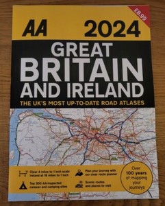
S$ 13.71S$ 35.07 shipping720 soldAA 2024 Great Britain & Ireland A3 Road Atlas Route Planner Map Large Scale UK
S$ 15.41S$ 26.56 shipping12 watchingOLD THORNABY 1913, Old Ordnance Survey Map, Yorkshire Sheet 56.04, Alan Godfrey
S$ 11.13S$ 6.55 shipping2017 Sydney & Blue Mountains Street Directory By UBD Gregory's Map
S$ 34.30Was: S$ 36.10S$ 19.51 shippingNEW HEMA Australia Road & 4WD Touring Atlas 13th Edition Spiral 187 Maps
S$ 34.10S$ 68.20 shippingWEST HERRINGTON 1915, Old Ordnance Survey Map, Durham Sheet 13.08
S$ 11.13S$ 6.55 shippingCollins World Atlas: Illustrated Edition by Collins UK
by Collins UK | PB | AcceptableS$ 7.22S$ 17.69 shippingChildren's Illustrated Animal Atlas By DK
S$ 16.54S$ 7.89 shippingThe Illustrated World Atlas by Weldon Owen (2010 Edition, Hardcover) -Rare
S$ 29.45S$ 146.04 shippingHistorical Maps Book: A State-By-State Atlas of U.S. History 1790-1990, 1st Ed.
S$ 25.08Was: S$ 29.51S$ 65.68 shippingVictoria Street Directory 18th ed by UBD Gregory's (Paperback, 2014)
S$ 26.77Was: S$ 28.18S$ 19.51 shipping4 Wessex Rambles Books Hampshire Dorset New Forest Pub Walks LN
S$ 27.45S$ 42.67 shippingWorld Atlas by Dorling Kindersley Publishing Staff (2010, Hardcover)
S$ 27.98S$ 88.09 shippingDiscovery Atlas by Thiago de Moraes ~ Hardback
S$ 24.02S$ 41.62 shippingStruan Reid Usborne Illustrated Atlas of Britain and Ireland (Hardback)
Another great item from Rarewaves | Free delivery!S$ 33.68S$ 2.92 shippingThe Kimberley Atlas and Guide Map - Hema Maps - 1st edition - large paperback
S$ 24.39S$ 36.98 shippingChildren's Illustrated World Atlas (DK Children's Illustrated Re
S$ 26.60S$ 7.89 shippingIllustrated History of Scotland,Chris Tabraham,Colin Baxter
S$ 6.13S$ 13.07 shippingBRADFORD 1915, Old Ordnance Survey Map, Yorkshire Sheet 216.08
S$ 10.21S$ 26.28 shipping2014, Green Guide/Michelin Series: "GREAT BRITAIN THE GREEN GUIDE" by Michelin
S$ 14.75S$ 53.31 shippingChildren's Illustrated Atlas
S$ 15.42S$ 35.15 shippingChildren's Illustrated Animal Atlas By DK
S$ 6.55S$ 13.07 shippingLondon Popup, Dominique Ehrhard,
S$ 24.24S$ 35.63 shippingMaps - Aleksandra & Daniel Mizielinski, 2013 Illustrated Hardback (Ages 6-12)
S$ 11.99S$ 40.99 shippingThe Times Concise Atlas of the World 11 Edition in slip case 2010
S$ 34.30S$ 82.92 shippingTexas Land Survey Maps for Harrison County
S$ 53.30S$ 56.25 shippingCollins World Atlas: Illustrated Edition by Collins Maps
S$ 21.98Was: S$ 25.72S$ 42.86 shippingFamily Maps of White County, Indiana Deluxe Edition
S$ 57.50S$ 69.95 shippingNational Geographic Family Reference Atlas Of The World~ 3rd ED (FC208-1Q560
S$ 100.33Was: S$ 118.03S$ 157.16 shippingFamily Maps of Choctaw County, Mississippi
S$ 56.10S$ 56.32 shippingEssential World Atlas (Eighth Edition) by DK Publishing, Comprehensive Guide to
S$ 5.91S$ 51.52 shippingZeppelins Over the Midlands: The Air Raids of 31st January 1916 by Mick Powis...
S$ 17.16S$ 41.09 shippingBRADFORD (North) 1915, Old Ordnance Survey Map, Yorkshire Sheet 2i6.04
S$ 11.13S$ 6.55 shippingThe Ordnance Survey Great British Treasure Hunt Puzzle Book Maps Sunday Times
S$ 8.58S$ 41.64 shippingGuide to Minerals, Vitamins and Supplements for Australia and New Zealand
S$ 19.51S$ 38.44 shippingLIVERPOOL (St. Michael's & Aigburth Vale) 1924, Old Ordnance Survey Map NEW
S$ 10.21S$ 26.28 shippingChildren's Illustrated Atlas (Children's Illustrated Atlases)
S$ 10.75S$ 40.77 shippingFamily Maps of LaGrange County, Indiana
S$ 53.30S$ 69.83 shippingO/S Explorer Map OL45 The Cotswolds, Burford, Chipping Campden Waterproof
S$ 12.01S$ 34.98 shippingCollins World Atlas: Illustrated Edition (Paperback)
S$ 54.99S$ 4.28 shippingKids' Illustrated World Map Folded by Rand McNally (2018, Hardcover)
S$ 8.84S$ 50.52 shipping