1960-1969 Date Range Antique Sheet Maps
1,210 Results
VINTAGE ADMIRALTY CHART. No.1453. PA-KO LIEH-TAO, CHINA EAST COAST. 1961 Edn.
S$ 72.56S$ 37.21 shippingVintage Telico Project Tennessee TVA Topographic Map 1965 Printed 1964 22x34
S$ 26.67S$ 44.04 shippingAntique/Vintage Map of Routes in Southern Iran, J.V. Harrison - 1942
S$ 30.71S$ 23.57 shippingAntique/Vintage Map of Population Distribution in Malaya 1945 - E.H.G Dobby
S$ 30.71S$ 23.57 shippingNew ListingVINTAGE SEA CHART / NAUTICAL MAP 1961 - The Wash - To Frame?
S$ 6.05S$ 11.16 shippingNational Geographic Map - The Earth's Moon 1969
S$ 17.05S$ 22.84 shippingSAINT PETERSBURG RUSSIA 1966 ANONYMOUS UNUSUAL ANTIQUE TOURISTIC CITY MAP
ORIGINAL COLORED LITHOGRAPHIC MAP OF SAINT PETERSBURGS$ 27.210 bidsS$ 37.07 shippingEnding Friday at 13:13 SGT2d 1hVINTAGE SEA CHART / NAUTICAL MAP 1961 - Hamble River - To Frame?
S$ 6.05S$ 11.63 shippingVINTAGE SEA CHART / NAUTICAL MAP 1961 - River Blackwater - To Frame?
S$ 6.05S$ 11.63 shippingVINTAGE SEA CHART / NAUTICAL MAP 1961 - Ireland Kilmakilloge Ardgroom & Sneem
S$ 6.05S$ 11.63 shippingVINTAGE SEA CHART / NAUTICAL MAP 1961 Ireland - Teelin & Killybegs Harbours
S$ 6.05S$ 11.63 shippingVINTAGE SEA CHART / NAUTICAL MAP 1961 - France - Rivers Aven & Belon, Houat,Tudy
S$ 6.05S$ 11.63 shippingVINTAGE SEA CHART / NAUTICAL MAP 1961 - France - Ile Du Bec To Argenton Porsal
S$ 6.05S$ 11.63 shippingALASKA -West Coast- Norton Sound to Bering Strait -1963 Used Original Large Map.
S$ 29.65S$ 50.13 shippingAntique Map of Luristan, Iran. From sheets by J.V. Harrison and NL. Falcon 1946
S$ 30.71S$ 23.57 shippingVINTAGE ADMIRALTY CHART. No.2140. NATUNA KEPULAUAN, CHINA SEA. 1963 Edition.
S$ 66.57S$ 34.04 shippingVINTAGE SEA CHART / NAUTICAL MAP 1961 - St Malo France
S$ 6.05S$ 11.63 shippingVINTAGE SEA CHART / NAUTICAL MAP 1961 - Shoreham Harbour & Langstone- To Frame?
S$ 6.05S$ 11.63 shippingNew ListingNational Geographic Map USA Original February 1968 United States
S$ 5.100 bidsS$ 28.51 shippingEnding 8 May at 2:00 SGT6d 14hVINTAGE SEA CHART / NAUTICAL MAP 1961 - Mersea Quarters- To Frame?
S$ 6.05S$ 11.16 shippingVINTAGE SEA CHART / NAUTICAL MAP 1961 Ireland - Westport Bay - To Frame?
S$ 6.05S$ 11.16 shippingVINTAGE SEA CHART / NAUTICAL MAP 1961 - France - Lezardrieux
S$ 6.05S$ 11.63 shippingVINTAGE SEA CHART / NAUTICAL MAP 1961 - France - Brest Approaches
S$ 6.05S$ 11.63 shippingVINTAGE SEA CHART / NAUTICAL MAP 1961 - France - Douarnenez & Audierne
S$ 6.05S$ 11.63 shippingNew ListingVintage 60’s USGS Topo Map Blackcap Mountain Maxon Dome Fresno CA Original Chart
S$ 29.58S$ 63.89 shippingVINTAGE SEA CHART / NAUTICAL MAP 1961 - Holland - Flushing Breskens Groningen
S$ 6.05S$ 11.63 shippingVINTAGE SEA CHART / NAUTICAL MAP 1961 - Lowestoft Harbour & Great Yarmouth Haven
S$ 6.05S$ 11.63 shippingVINTAGE SEA CHART / NAUTICAL MAP 1961 - Cherbourg
S$ 6.05S$ 11.63 shippingAntique/Vintage Map of Northern Papua, Bamu Purari Patrol 1936
S$ 30.71S$ 23.57 shippingUnited States Department Of The Interior Survey Juanita Arch Quad Colorado Mesa
S$ 50.41Was: S$ 59.31S$ 117.09 shippingAntique Map of Cape Town with many details relating to race and multiculturalism
S$ 59.73S$ 33.68 shippingAntique/Vintage Map of Northern Territory, Australia - 1949
S$ 30.71S$ 23.57 shippingVINTAGE SEA CHART / NAUTICAL MAP 1961 - Sheerness & West Swale - To Frame?
S$ 6.05S$ 11.63 shippingVINTAGE SEA CHART / NAUTICAL MAP 1961 - Ireland - Kinsale - To Frame?
S$ 5.56S$ 11.16 shippingOrdnance map SD 4263/4363 Morecambe 1962 West End Pier, Sandylands, Marine Road
S$ 10.220 bidsS$ 29.29 shippingEnding Saturday at 19:19 SGT3d 7hNew ListingOrdnance map SU41SE Southampton, 1968 West End, Bursledon, Sholing, Hedge End
S$ 10.220 bidsS$ 30.15 shippingEnding 8 May at 3:35 SGT6d 15hRARE Ordnance map NZ24SW Bearpark, 1966 Durham 2 miles, Ushaw, New Brancepeth
S$ 10.220 bidsS$ 29.29 shippingEnding Saturday at 19:20 SGT3d 7hAntique/Vintage Map of Coastal Scenery of the United Kingdom - 1944
S$ 17.05S$ 22.84 shippingVintage Camptonville Quad 7.5 Minute CA Map US Dept Int Geological Survey 1969
S$ 88.96S$ 46.25 shippingUSPS Topographic Map Vintage Moodus Connecticut Original Printed 1967 19x27
S$ 22.24S$ 40.40 shippingNational Geographic Map - West Indies - 1962 - Vintage
S$ 25.59S$ 23.28 shippingVINTAGE SEA CHART / NAUTICAL MAP 1961 - TORQUAY & BRIXHAM Harbours - To Frame?
S$ 6.05S$ 11.63 shippingVINTAGE SEA CHART / NAUTICAL MAP 1961 - Chichester - To Frame?
S$ 6.05S$ 11.16 shippingNational Geographic Map - Indian Ocean Floor - 1967 - Vintage
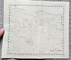
S$ 34.12S$ 32.30 shippingAntique/Vintage Map of Libya (Fisher) - 1953
S$ 22.17S$ 23.11 shippingNational Geographic Map - Australia - 1963 - Vintage
S$ 22.17S$ 23.11 shippingVINTAGE SEA CHART / NAUTICAL MAP 1961 - Rye Harbour - To Frame?
S$ 6.05S$ 11.63 shippingVintage RAC Europe Road Map Folding Paper Sheet Map
S$ 12.38S$ 22.58 shipping1964 VINTAGE McCormick's & Co. PICTORIAL WORLD MAP Coffee~ Spice Trade Routes
S$ 88.95S$ 46.02 shippingVINTAGE SEA CHART / NAUTICAL MAP 1961 - Honfleur
S$ 6.05S$ 11.63 shippingVINTAGE SEA CHART / NAUTICAL MAP 1961 - St Peter Port Channel Islands
S$ 6.05S$ 11.63 shippingVINTAGE SEA CHART / NAUTICAL MAP 1961 - Channel Islands - Alderney & St Helier
S$ 6.05S$ 11.63 shippingVINTAGE SEA CHART / NAUTICAL MAP 1961 - Dover Ramsgate Folkestone - To Frame?
S$ 6.05S$ 11.63 shippingVINTAGE SEA CHART / NAUTICAL MAP 1961 Isle Of Man - Various Locations
S$ 6.05S$ 11.63 shippingVINTAGE SEA CHART / NAUTICAL MAP 1961 - France - Morbihan
S$ 6.05S$ 11.63 shippingVINTAGE SEA CHART / NAUTICAL MAP 1961 - Leith Kirkcaldy Granton Grangemouth
S$ 6.05S$ 11.63 shippingVINTAGE SEA CHART / NAUTICAL MAP 1961 - St Tudwal’s & Holyhead - To Frame?
S$ 6.05S$ 11.63 shippingVINTAGE SEA CHART / NAUTICAL MAP 1961 - Newhaven & Littlehampton - To Frame?
S$ 6.05S$ 11.63 shippingHartford South Connecticut Antique Original Topographic Map Printed 1964 19x27
S$ 22.24S$ 40.40 shippingVintage Milford Pennsylvania USGS Topographic Map Printed 1969 20x27
S$ 22.24S$ 40.40 shipping